
Sovereign state United Kingdom Postcode district LE7 Local time Tuesday 11:36 AM | ||
 | ||
Weather 8°C, Wind W at 31 km/h, 54% Humidity | ||
Queniborough flood afterwards
Queniborough is a village in the county of Leicestershire, United Kingdom just north of Syston and to the north of Leicester. There are 972 properties in the village and 1,878 registered electors (2003), increasing to 2,326 at the 2011 census. Due to its proximity to Leicester it forms part of the Leicester Urban Area. The parish church of St Mary's has, according to architectural historian Nicholas Pevsner, "one of the finest spires in the whole of Leicestershire".
Contents
- Queniborough flood afterwards
- Map of Queniborough Leicester UK
- Crazy hail in leicester queniborough
- History
- Buildings and facilities
- References
Map of Queniborough, Leicester, UK
Crazy hail in leicester queniborough
History
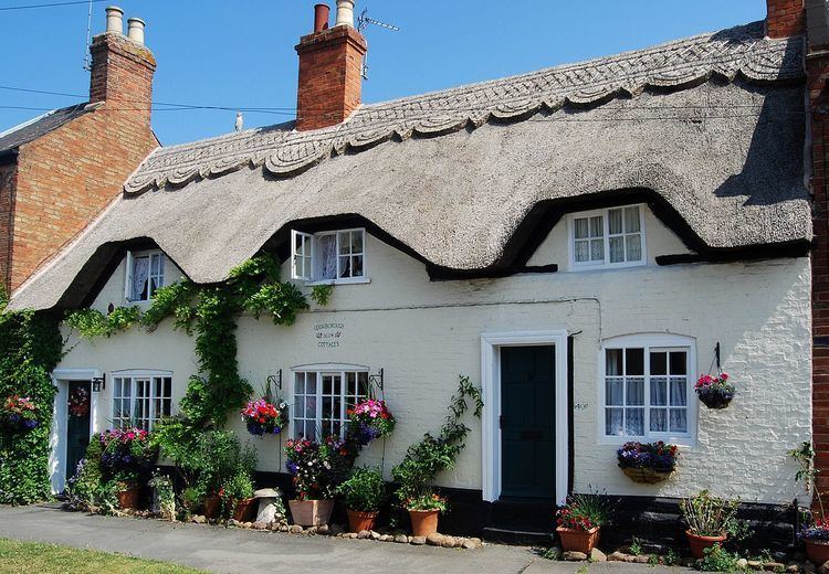
The old part of the village, along Main Street, has a mixture of 16th–20th century houses, some thatched.
The Grade II*-listed Queniborough Old Hall in Coppice Lane is a large two-storey country house built in 1675–76 of brick, with Swithland slate roofs to an originally H-shaped floor plan.
The newer Queniborough Hall in Main Street was built about 1820 with later additions. It has two storeys of stuccoed brick with a four-bay frontage. Until the First World War it was still occupied by the Lord of the Manor, but it has now been converted into flats.
What is now known as Wetherby House was built about 1850 and is believed to have been known as The Beeches. It stands on Syston Road. The house is built of brick with a pitched Swithland slate roof and is listed as of local interest.
There was no school in the village open to ordinary villagers until 1847. The earlier school, in a small building to the rear of No. 28, Main Street, was only for children whose parents worked on the Queniborough Hall estate. Nos 22–28, Main Street were built between 1790 and 1810 as workers' cottages. The schoolmaster lived at No. 28. The row is still occupied, and the old village school, part of No. 28, now serves as a dining room with a 15-foot (4.6 m) vaulted ceiling.
The school built in 1847 stands beside the Horse and Groom. This was a free school from the outset, available to the children of all villagers. It is now used as a small swimming pool for the new primary school built in the 1970s. A junior school was built in Coppice Lane and opened in September 1954.
Buildings and facilities
There are two public houses, the Horse and Groom and the Britannia Inn, both in the centre of the old part of the village. Next door to the Horse and Groom is the Queniborough branch of the British Legion, which has a bar and hall. There is also a butcher/delicatessen and a ladies' and gents' hairdresser.
The properties in the newer part of the village from Queniborough Road to Syston Road are all from the 20th century. Here there is also a post office and corner shop, and a newsagent and general store. In the same end of the village stands a village hall completed in 1973, which is used for keep-fit, badminton and other activities, and for a pre-school playgroup. The local Scouts have a hall of their own. The school hall in Coppice Lane is used by Guides, Brownies, Rainbows and Weight Watchers, and many other clubs, and holds winter fairs and other celebrations.
The village has a sports field marked out mainly for football, for which Queniborough has teams in the junior and senior leagues. The King George playing field is a secure playground for young children, with swings and roundabouts. There is a public footpath to South Croxton that follows Queniborough Brook. A recent acquisition is a village tennis court completed in 2005, situated within the King George playing field.