
Average_Earnings $43,089 Population 77,866 (2011) | Area 2,020 km² | |
 | ||
Incorporated Towns & Municipalities Parishes Greenville Parish, Hillsboro Parish, Charlotte Parish, Bedford Parish, St. John's Parish, St. Patrick's Parish Townships and royalties ListQueens Royalty, Lot 20, Lot 21, Lot 22, Lot 23, Lot 24, Lot 29, Lot 30, Lot 31, Lot 32, Lot 33, Lot 34, Lot 35, Lot 36, Lot 37, Lot 48, Lot 49, Lot 50, Lot 57, Lot 58, Lot 60, Lot 62, Lot 65, Lot 67 Destinations Charlottetown, Prince Edward Island National Park Points of interest Confederation Centre of the Arts, Province House, Victoria Park - Charlottetown, St Dunstan's Basilica, Confederation Trail Colleges and Universities University of Prince Edward Is, Holland College, Maritime Christian College | ||
Queens County is located in central Prince Edward Island, Canada. The county is geographically divided by the Hillsborough River's estuary, a tidal inlet which almost splits the county and Prince Edward Island. It is the richest and most populous county in the province of Prince Edward Island.
Contents
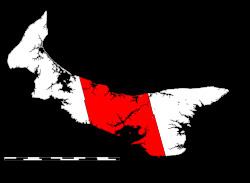
Map of Queens County, PE, Canada
The county's geography varies from picturesque shorelines of sandstone cliffs, sandy beaches and sheltered bays on the Gulf of St. Lawrence and Northumberland Strait, to extensive farming operations throughout interior regions. Topography ranges from relatively flat to rolling hills in the central hill lands known as the Bonshaw Hills.
The county was named by Captain Samuel Holland in 1765 for Charlotte of Mecklenburg-Strelitz, then queen consort of the United Kingdom. As such, Queens County's county seat is Charlottetown, which was also chosen as the colonial capital because of its central location.
Today, urban sprawl extending from Charlottetown in the centre of the county is the region's most dominant feature; many rural parts of the county within the Charlottetown census agglomeration, and outside, are facing increased pressures to subdivide and develop into suburbs and exurbs.