
 | ||
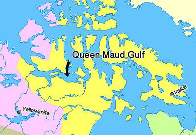
Queen Maud Gulf (68°20′N 102°00′W) lies between the northern coast of the mainland and the southeastern corner of Victoria Island in Nunavut, Canada. At its western end lies Cambridge Bay, leading to Dease Strait; to the east lies Simpson Strait; and to the north, Victoria Strait.
Contents
Map of Queen Maud Gulf, Kitikmeot, Unorganized, NU, Canada
History
In 1839 it was crossed by Peter Warren Dease and Thomas Simpson. It was named by the Norwegian explorer Roald Amundsen in 1905 for the Norwegian queen Maud of Wales.
The wreck of the HMS Erebus from lost Franklin Expedition of 1845 to the Northwest Passage was found in 2014. The wreck lies at the bottom of the eastern portion of Queen Maud Gulf, west of O'Reilly Island.
References
Queen Maud Gulf Wikipedia(Text) CC BY-SA