
Time zone China Standard (UTC+8) Local time Tuesday 2:01 AM | Area 30,339 km² | |
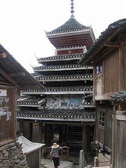 | ||
Country People's Republic of China Weather 9°C, Wind N at 6 km/h, 95% Humidity Points of interest China Xijiang Qianhu M, Lang Deshangzhai, China Lishiwenhua Mingchen, Basha Miao Village, Qinglongdong | ||
Qiandongnan Miao and Dong Autonomous Prefecture (simplified Chinese: 黔东南苗族侗族自治州; traditional Chinese: 黔東南苗族侗族自治州; pinyin: Qiándōngnán Miáozú Dòngzú Zìzhìzhōu) , also known as Southeast Qian Autonomous Prefecture of Miao and Dong and can be shortened as S.E. Qian Prefecture, is an autonomous prefecture in the southeast of Guizhou province in the People's Republic of China, bordering Hunan to the east and Guangxi to the south. The seat of the prefecture is Kaili. Qiandongnan has an area of 30,339 km2 (11,714 sq mi).
Contents
Map of Qiandongnan, Guizhou, China
Demographics
According to the 2000 Census Qiandongnan has 3,844,697 inhabitants with a population density of 126.72 inhabitants/km².
Subdivisions
The prefecture is subdivided into 16 county-level divisions: 1 county-level city and 15 counties
References
Qiandongnan Miao and Dong Autonomous Prefecture Wikipedia(Text) CC BY-SA