
 | ||
Qaidam basin china road trip 2016 1080p yuneec cgo3 camera gopro iphone 7
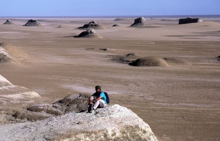
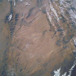
Qaidam Basin, also spelled Tsaidam (Mongolian: Цайдам, from Standard Tibetan: ཚྭའི་འདམ་,"salt marsh"; simplified Chinese: 柴达木盆地; traditional Chinese: 柴達木盆地; pinyin: Cháidámù Péndì) is an hyperarid basin that occupies a large part of the Haixi Mongol and Tibetan Autonomous Prefecture in Qinghai Province, western China. The basin covers an area of approximately 120,000 km2, one fourth of which is covered by saline lakes and playas. By one count, there are 27 such lakes in the basin. Around 35,000 square kilometers, or one third of the basin is desert, which is known in Chinese as Chaidamu Pendi Shamo (柴达木盆地沙漠), i.e. Qaidam Basin Desert.
Contents
- Qaidam basin china road trip 2016 1080p yuneec cgo3 camera gopro iphone 7
- Qaidam basin
- Minerals and mining
- References
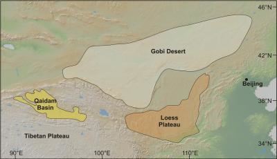
The Qaidam Basin forms a sort of shelf on the northeast side of the Tibetan Plateau. The Tibetan Plateau is at least 14,000 feet (4,300 m) above sea level, the Qaidam about 10,000 feet (3,000 m) and Gansu to the north about 3,000 feet (910 m) to 4,000 feet (1,200 m). A low water divide separates the Qaidam Basin proper from that of Qinghai Lake to the east.
Orographically, the Qaidam Basin is a comparatively low area in the northeastern part of the Tibetan Plateau. Qaidam is an intermontane basin, i.e. it is surrounded on all sides by mountain ranges. In the south, the Kunlun Mountains separate it from the higher central section of the Tibetan Plateau. In the north, a number of smaller ridges (Shulenanshan, etc.) separate the basin from another higher plateau, which is more known for its northern escarpment, the Qilian Mountains; that entire mountain system is often generically known as Nanshan. In the northwest, the Altyn-Tagh separates the Qaidam Basin from the Kumtagh Desert of southeastern Xinjiang.
Qaidam basin
Minerals and mining
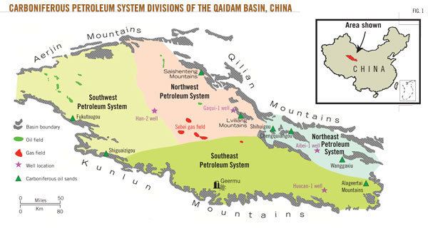
The basin's large mineral deposits caused a great deal of investment interest from 2005. It has reserves of asbestos, borax, gypsum, oil and natural gas, and several metals, with the greatest reserves of lithium, magnesium, potassium and sodium of anywhere in China. Qaidam is also home to the Qarhan Lake (察尔汗盐湖), which contains sixty billion tons of salt. There are 22 oilfields, with estimated reserves of 225 million tons, and 6 gasfields, holding 150 billion cubic metres of gas.
The Xining-Golmud rail line (the first stage of the Qinghai–Tibet Railway), which crossed the eastern part of the Qaidam Basin in the early 1980s, is an essential transportation link for accessing the region's mineral resources. As of 2012, additional rail lines are under construction. The construction of the Golmud–Dunhuang Railway started in October 2012; it is expected to be completed within 5 years. In the early 2012, Zangge Potash Co Ltd started the construction of a 25-km private railway from the Chaerhan (Qarhan) station on the Qinghai–Tibet Railway (near the eponymous salt lake) to their facilities nearby.
As of the late 2013, preliminary planning is conducted for the Korla-Golmud Railway, which, if constructed, will stretch along the entire western part of the Qaidam Basin as well.