
Administrative center of Pyt-Yakh Urban Okrug Local time Monday 2:51 AM | Urban okrug Pyt-Yakh Urban Okrug Area 80.4 km² | |
 | ||
Federal subject Khanty–Mansi Autonomous Okrug Administratively subordinated to town of okrug significance of Pyt-Yakh Administrative center of town of okrug significance of Pyt-Yakh Weather -8°C, Wind SW at 10 km/h, 77% Humidity Points of interest Kraevedcheskiy ekomuzey, IVOLGA, Victory Square | ||
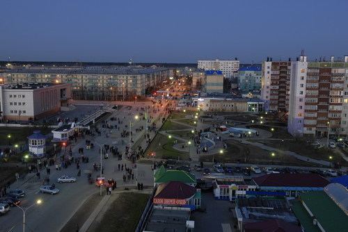
Pyt-Yakh (Russian: Пыть-Ях) is a town in Khanty–Mansi Autonomous Okrug, Russia, located on the east bank of the Bolshoy Balyk River, southeast of Khanty-Mansiysk. Population: 41,488 (2010 Census); 41,813 (2002 Census); 17,101 (1989 Census).
Contents
- Map of Pyt Yakh Khanty Mansi Autonomous Okrug Russia
- Monopoly party pyt yakh
- History
- Administrative and municipal status
- Economy
- References
Map of Pyt-Yakh, Khanty-Mansi Autonomous Okrug, Russia
Monopoly party pyt yakh
History
The town was formed by merging the settlements of Mamontovo and Pyt-Yakh in 1990. The name of the town means "place of good people" in the Khanty language.
Administrative and municipal status
Within the framework of administrative divisions, it is incorporated as the town of okrug significance of Pyt-Yakh—an administrative unit with the status equal to that of the districts. As a municipal division, the town of okrug significance of Pyt-Yakh is incorporated as Pyt-Yakh Urban Okrug.
Economy
The town's economy is based on oil and natural gas extraction.