
Location Chile Mountain range Andes | Elevation 5,703 m Age of rock Holocene | |
 | ||
Mountain type Pyroclastic shield, volcanic complex Similar Caichinque, Cochiquito Volcanic Group, Cerro del Azufre, Yanteles, Huanquihue Group | ||
The Puricó Complex is a pyroclastic shield consisting of two ignimbrite sheets that is located in the eastern part of the Atacama Desert in Chile's II Region (Antofagasta), approximately 5 km (3 mi) south of the Bolivia - Chile border. The volcanic complex is on top of a massive pyroclastic shield, covering an area of roughly 20 km (12 mi) x 30 km (19 mi) and is conformed by ten subsidiaries, including two stratovolcanoes, five lava domes, one cinder cone, and one maar. The highest of its multiple peaks is 5,703 metres (18,711 ft). Juriques to the north and Guayaques to the east are separate volcanic systems.
Contents
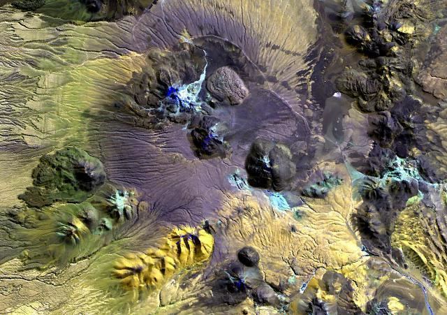
Map of Purico Complex, San Pedro de Atacama, Antofagasta Region, Chile
The two ignimbrite sheets making up the complex and shield erupted about 1.3 million years ago, along with several stratovolcanoes and lava domes that define a postulated 10 x 20 km ring fracture. Cerro Toco overlies the vent area of the Cajón Ignimbrite and a sulfur mine on Cerro Toco's southeast flank was mined until the early 1990s. Cerro Chascón de Purico and Cerro Aspero are of Holocene age. Both lava domes differ morphologically from many other flat-topped silicic Andean volcanic domes and have 300-400 metre-high conical profiles. Cerro Chascón was formed by a series of viscous lava flows while Cerro Aspero appears to be a single Peléan-type dome. The Chascón de Puricó dacitic lava dome rising 1,200 metres above the shield has a well-preserved summit crater and lava flows that do not show evidence of glacial modification. The dacitic-to-andesitic Cerros de Macón stratovolcano lies at the SW end of the Puricó Complex, and the Alitar maar at the southeast end displays constant solfataric activity.
The Chajnantor Science Reserve (Spanish: Reserva Científica de Chajnantor) contains most of the Puricó Complex, and is home to the Llano de Chajnantor Observatory and other astronomical facilities.