
 | ||
La guajira punta gallinas cabo la vela parque macuira colombia como viajar que visitar
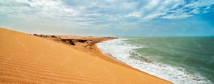
Punta Gallinas (Cape Gallinas, "Cape Hens") is a headland in northern Colombia and the northernmost point on the mainland of South America and one of the Extreme points of South America.
Contents
- La guajira punta gallinas cabo la vela parque macuira colombia como viajar que visitar
- Map of Punta Gallinas Uribia La Guajira Colombia
- Rondscheuren op punta gallinas colombia
- Geography
- History
- References
Map of Punta Gallinas, Uribia, La Guajira, Colombia
Rondscheuren op punta gallinas colombia
Geography
Punta Gallinas is situated in the northern part of the department of La Guajira Department on the coast of the Caribbean Sea.
The cape is at the northern tip of the Guajira Peninsula (Península de la Guajira) in the municipality of Uribia about 150-kilometre (93 mi) northeast of Riohacha.
History
The area has been populated by the indigenous Wayuu people for a long time.
The headland is also the location of the northernmost lighthouse in South America the 18 m (659 feet) high Faro de Punta Gallinas opened in 1989.
References
Punta Gallinas Wikipedia(Text) CC BY-SA