
Elevation 103 m Number of airports 1 | Local time Wednesday 7:29 PM | |
 | ||
Weather 28°C, Wind NE at 0 km/h, 82% Humidity | ||
Tren de la muerte puerto su rez santa cruz de la sierra trampos buenos 07 11 2012
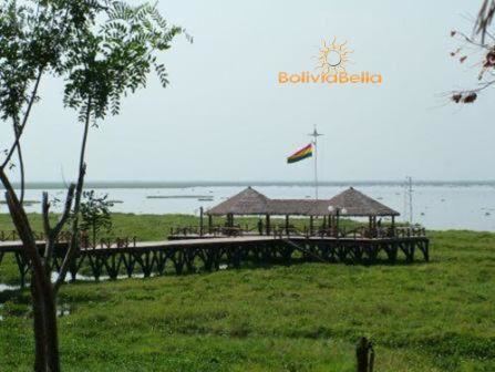
Puerto Suárez is an inland river port and municipality in Santa Cruz Department, Bolivia. It is located 10 km west of the border with Brazil.
Contents
- Tren de la muerte puerto su rez santa cruz de la sierra trampos buenos 07 11 2012
- Map of Puerto SuC3A1rez Bolivia
- Location
- Transport
- Population
- References
Map of Puerto Su%C3%A1rez, Bolivia
Location
Puerto Suárez is located in the province of Germán Busch, Santa Cruz Department and situated by Laguna Cáceres which is connected to the important Río Paraguay and Río Paraná waterway by the Tamengo Canal.
Transport
The municipality is connected to the city of Santa Cruz in the west and Brazil in the east by major roads and rail-links as well as by an airport.
In 2013, a railway connection to the Peruvian port of Ilo was proposed.
Puerto Suarez International Airport has some commercial airline service.
Population
The town was founded on November 10, 1875 by Miguel Suárez Arana. The population was 11,564 (2001 census) and has increased to 12,546 (2007 estimate), some sources even say 20-22,000.