
Peak Workman Hill | Elevation 424 m (1,391 ft) | |
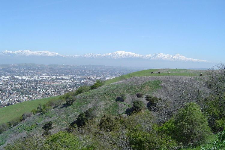 | ||
The Puente Hills is a chain of hills, one of the lower Transverse Ranges, in an unincorporated area in eastern Los Angeles County, California, USA. The western end of the range is often referred to locally as the Whittier Hills.
Contents
GeographyEdit
The Puente Hills lie to the south of the San Gabriel Valley and the Pomona Freeway (State Route 60), to the east of the San Gabriel River Freeway (Interstate 605), to the north of Whittier Boulevard, and to the west of the city of Diamond Bar and Chino Hills. Cities to its north are the City of Industry, Hacienda Heights, and Rowland Heights. To the south are Whittier, La Habra Heights, and Brea. The Brea-Olinda Oil Field, discovered in 1880 and still producing in 2014, is in the southernmost portion of the hills adjacent to the city of Brea.
FloraEdit
The Puente Hills are in the California chaparral and woodlands ecoregion of the California Floristic Province. The remnant California native plants here are in the chaparral and oak woodland plant communities, with stands of California native grasses. Vascular Plants of the Whittier Hills, a floristic study, was completed by Julie A. Schneider Ljubenkov and Timothy S. Ross (2001), and published in Crossosoma. It built on the work of Bob Muns.
LandmarksEdit
Rio Hondo Community College is located at the foot of the western end of the hills, and the Puente Hills Landfill is nearby. Rose Hills Memorial Park occupies portions of the northern area. The highest point in the western hills is Workman Hill, named for the pioneer Workman family. The Puente Hills Mall is located north of the hills. Hsi Lai Temple in Hacienda Heights, the second largest Buddhist temple and monastery in the western hemisphere, is located in the hills.
In the 1953 film adaptation of H. G. Wells' science-fiction novel The War of the Worlds, the Puente Hills were the landing site of the first spacecraft in the Martian invasion.
In the scene from Back to the Future (1985 film), Doc Brown introduces the iconic Delorean time machine in the parking lot of Puente Hills Mall.
ParksEdit
Puente Hills is home to the Puente Hills Landfill, the country's largest active landfill. The high-tech landfill has begun offering tours. The Puente Hills Landfill Native Habitat Preservation Authority directs the acquisition, restoration, and management of open space in the Puente Hills for preservation of the land to protect the biological diversity and provide opportunities for outdoor education and low-impact recreation, and scheduled hikes are offered. A
Hellman Wilderness Park is located in the western Puente Hills ("Whittier Hills") with trailheads in Whittier. It is managed by the Puente Hills Habitat Preservation Authority. It has trails into native coastal sage scrub habitats, and up to vistas of the Los Angeles Basin.
Schabarum Regional Park is partially in the eastern Puente Hills, in Rowland Heights, eastern Los Angeles County, California. It has equestrian and hiking trails in the hills.
Oil drillingEdit
There has been a long history of oil drilling in the Puente Hills. In the early 20th century, several companies drilled, including Simon Murphy's Murphy Oil Company. Recently, Matrix Oil has proposed resumption of oil drilling on several acres in the Puente Hills.