
 | ||
Public transport in Sydney is provided by an extensive network of operating modes including commuter rail, light rail, buses and ferries. According to the 2006 census, in terms of travel to work or study Sydney has the highest rate of public transport usage among the Australian capital cities of 26.3% with more than 80% of weekday trips to/from Central Sydney being made by public transport. According to the New South Wales State Plan, the state has Australia's largest public transport system. The network is regulated by Transport for NSW, which is working towards an integrated network serving Sydney, Newcastle, the Central Coast, the Blue Mountains, Wollongong and the Illawarra.
Contents
- Ticketing
- Bus
- Network
- Heavy rail
- Trams and light rail
- Sydney Ferries
- Other passenger ferry operators
- Vehicle ferries
- References
Sydney's early urban sprawl can be traced in part to the development of its passenger rail network. The first rail services began in 1855, 67 years after the settlement's foundation and a tram network which began in 1861, becoming the Southern Hemisphere's largest by the 1920s. This rail infrastructure allowed working-class suburbs to develop at a large distance from the city centre.the Sydney Metro is a forthcoming transport service in Sydney, with an estimated completion date around 2019–2020.
Ticketing
In April 2010 the NSW Government introduced MyZone, a standardised fare structure, to simplify the previously complex fares. Government-run bus, train and ferry operators share an inter-operator Automated Fare Collection System, based on magnetic stripe technology.
The Opal smartcard has been introduced, with the rollout started in December 2012 and completed in December 2014.
Fares are controlled by the Independent Pricing and Regulatory Tribunal of New South Wales. Operators must demonstrate value to passengers before IPART will allow fare increases above the level of inflation. In practice, this has kept fares artificially low, costing the NSW Government more to provide services. The perceived need for higher fares was a key theme in the 2003 Ministerial inquiry into sustainable public transport in New South Wales.
As of January 2009, Sydney public transport prices were slightly higher than in other mainland cities.
Bus
Commuter bus services account for about half of the public transport journeys taken in the city on weekdays. Of the 921,000 weekday bus trips, 554,000 are provided by the State Transit Authority of New South Wales, a government authority, the remainder by a number of private-sector operators.
East of Strathfield, the majority of the bus network replaces the city's former tram network. Sydney Buses, a subsidiary of the State Transit Authority of New South Wales, operates a network tightly integrated with train and ferry services. Further from the CBD, services are generally operated by private-sector companies under contract to the NSW Government authority Transport for NSW. Under pressure from bus contracting reforms, many of the private bus companies have merged or entered into joint ventures. The largest private bus operator is ComfortDelGro Cabcharge, owners of Hillsbus. Other significant players include Punchbowl Bus Company, Busways and Transdev NSW.
Bus services in the regions surrounding Sydney are considered part of the metropolitan network. Apart from the city of Newcastle, where State Transit subsidiary Newcastle Buses & Ferries operates bus and ferry services, outer-metropolitan services are provided by the private sector under contract to Transport for NSW. Here, ComfortDelGro Cabcharge, Busways and Premier Illawarra are significant players.
Network
Sydney's bus network has been divided into different regions. Of these regions, bus routes are classified with three-digit route numbers:
Special services are denoted by letter prefixes in their route number:
Currently, Sydney has two operating T-Ways:
Additional bus networks operate in the Outer Sydney region, which include:
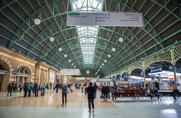
Heavy rail
Passenger rail services within Sydney are provided by Sydney Trains. Sydney's suburban commuter rail service consists of a complex system of integrated railway lines, of which most run through the city underground. All city trains consist of eight double deck carriages with two crew members on board - driver and guard. Fares are calculated on the basis of distance travelled. Trains run from 4am until around 1am seven days a week with Nightride bus services covering the network throughout the night when trains are not operating.
In October 2012, a report published by PwC found the rail system performed poorly compared to many metro services from 27 other major world cities. Sydney was ranked as the fourth-worst public train system, beating only Los Angeles, São Paulo and Johannesburg for operation efficiency and coverage, while being proven to have the most expensive tickets of any major city public transport system.
After the release of this report, many changes have been made to the rail system, starting with the 2013 restructure of RailCorp resulting in Sydney Trains running all metropolitan services and NSW TrainLink for all Intercity services. Since this and other changes, there has been some improvement according to the 2014 update of the same study. Sydney is now 6th worst globally, as opposed to 4th worst in 2012, beating out Jakarta, Los Angeles, Istanbul, Johannesburg and Nairobi. São Paolo also improved to two spots ahead of Sydney. Reasons for the upward swing include costing and improvements in efficiency, reliability and safety. Regarding cost of transport, Sydney has dropped to 2nd most expensive, behind London. This is the result of the rollout of the Opal Card for all Sydney's public transport, which although has only seen fares increase multiple times for single journeys, does offer free journeys at the end of the week for regular users and daily cap limits. Since the 2014 report, there was an announcement of approval for the Sydney Metro project, which will involve an entirely new rapid transit line servicing Sydney's eastern suburbs. The underground system, comparable to the New York Subway or the Paris Metro in terms of functionality, will significantly reduce congestion and provide speedier service to commuters.
NSW TrainLink Interurban trains operate from Central railway station to the Illawarra, Southern Highlands, Blue Mountains, Central Coast and Newcastle. This station is also the terminus for NSW TrainLink's long distance trains to numerous destinations in country New South Wales as well as Melbourne and Brisbane. The Indian Pacific also operates to Adelaide and Perth.
Criticism directed at Sydney's rail infrastructure (and overall public transport network) has been rife over the years, particularly as many plans for expansion or modification have been thwarted by opposing residents and council attitudes. Historically, Sydney's rail system has not changed significantly since John Bradfield–designer of the Sydney Harbour Bridge–conceptualised his vision of a rail network in the 1930s, later updated in 1956. The system was to include electrification of suburban rail networks as well as an underground train system much like The Tube in London. The onslaught of World War I led to these proposals collapsing and significant modification had not materialised up until the 21st century. Western Sydney's population, for example, has increased fivefold since 1940 but its rail lines have extended just 20 kilometres. The 2012 announcement and construction of the Sydney Metro has been designed to ease constraint and closely matches Bradfield's visions for an underground rail network.
Trams and light rail
Sydney once had the Southern Hemisphere's largest tram network. Patronage peaked in 1945 at 405 million passenger journeys. The system was in place from 1861 until its winding down in the 1950s and eventual closure in 1961. It had a maximum street mileage of 291 km (181 miles) in 1923. A short heritage tramway operated by the Sydney Tramway Museum has linked Loftus railway station and the Royal National Park since the 1990s.
In 1997, trams returned to Sydney in the form of a short light rail line between Central and Pyrmont. The line was extended twice and is now 12.8 km long. A second line, passing through Sydney's CBD from Circular Quay to the south eastern suburbs is due to commence construction late 2014–early 2015 and be completed in 2019–2020.
Sydney Ferries
Sydney Ferries runs numerous commuter and tourist ferries on Sydney Harbour and the Parramatta River. Harbour ferries are used in equal measure by commuter and leisure users; Parramatta River ferries are overwhelmingly used for leisure and tourist trips. Sydney Ferries operates nine routes, with approximately 14,000,000 passengers per year. Sydney Ferries operates from Circular Quay Ferry Terminal, a major transport hub in Sydney's central business district, with popular routes including services to the beachside suburb of Manly and to Taronga Zoo, a major tourist attraction. Sydney Ferries also operates sightseeing cruises for tourists.
Other passenger ferry operators
Several private sector companies run passenger ferries in the Sydney region. These include:
Vehicle ferries
Several car ferries form part of Sydney's road system. These ferries are controlled by a combination of the Roads and Maritime Services and local government, and are toll-free. They include: