
Country Thailand Postal code 55120 Population 64,813 (2015) Geocode 5505 | Time zone ICT (UTC+7) Area 657.4 km² Province Nan Province | |
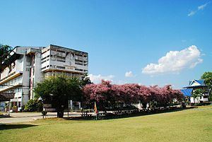 | ||
A day in pua district north thailand
Pua (Thai: ปัว, [pūa̯]) is a district (amphoe) in the central part of Nan Province, northern Thailand.
Contents
- A day in pua district north thailand
- Map of Pua District Nan Thailand
- Kathin festival 2012 pua district nan province thailand
- Geography
- Central administration
- Local administration
- Economy
- References
Map of Pua District, Nan, Thailand
Kathin festival 2012 pua district nan province thailand
Geography
Neighboring districts are, from the north clockwise, Chiang Klang, Thung Chang, Chaloem Phra Kiat, Bo Kluea, Santi Suk, and Tha Wang Pha.
Doi Phu Kha National Park is Thailand's largest national park, covering several districts of Nan Province. The national park office as well as the 1,980 m high Doi Phu Kha in the Luang Prabang Range itself are within Pua District.
Central administration
The district Pua is subdivided into 12 subdistricts (Tambon), which are further subdivided into 107 administrative villages (Muban).
Missing numbers belong to tambon which are now part of Bo Kluea district.
Local administration
There are 2 subdistrict municipalities (Thesaban Tambon) in the district:
There are 10 subdistrict administrative organizations (SAO) in the district:
Economy
Pua District is heavily agricultural. It is a significant maize-growing area. Farmer's zeal to clear more land for maize cultivation has led to deforestation of vast tracts of hillsides, resulting in "bald mountains" (Thai: เขา้หัวล้าน; rtgs: khao hua lan). A by-product of the land clearing is smoke from field burning, contributing to the northern region's significant air pollution. Charoen Pokphand (CP) Group, Thailand's largest agro-industrial and food conglomerate, and the leading purchaser of Pua District maize, in March 2016 announced an "agricultural social enterprise" to steer district villagers away from maize farming. CP Group has incurred criticism for the way it purchases maize harvests for animal feed from farmers in Nan and other provinces. Suphachai Chearavanont, vice-chairman of CP Group, said that corn planters will be encouraged to grow cash crops such as coffee, which requires less farmland and makes a higher profit than maize. Not only will this address the bald-mountain problem, he said, but it will also help reduce the spring haze in the north which is caused by slash-and-burn practices to prepare land for the next maize season. Mr Suphachai said crops like coffee take about three-and-a-half years to show a yield, but stated that CP Group would stand by farmers and provide assistance in the meantime.