
Local time Thursday 8:29 AM | ||
 | ||
Weather 24°C, Wind NE at 0 km/h, 69% Humidity | ||
Puʻunēnē is an unincorporated community in the central part of Maui, Hawaii, near Kahului. Although the land in that area is fairly level, the words Puʻu nēnē mean "nene goose hill" in Hawaiian. With a population of around 50, Puʻunēnē's primary industry is growing, harvesting and processing sugarcane.
Map of Puunene, Kahului, HI 96732, USA
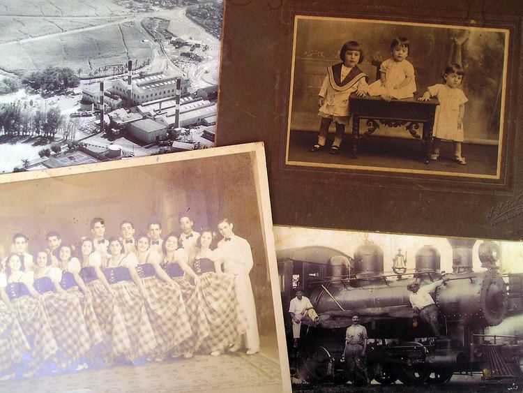
The nonprofit Alexander & Baldwin Sugar Museum is housed in the former residence of the superintendent of Puʻunēnē Sugar Mill, which the Hawaiian Commercial & Sugar Company (a division of Alexander & Baldwin) has operated across the street since 1901. Its mission is "to preserve and present the history and heritage of Hawaii's sugar industry, and the multi-ethnic plantation life which it engendered." Also located in Puʻunēnē is the Puʻunēnē School, which is listed on the National Register of Historic Places.
Puʻunēnē's Zip code is 96784. The mill is located at 20°52′3″N 156°27′16″W, just east of Mokulele Highway, Hawaii Route 311.
About three miles to the south of Puʻunēnē is the site of a former Naval Air Station (1940–1947),20°48′59″N 156°27′38″W. An old runway is now used as a drag strip for Maui Raceway Park.