
Length 145 km | ||
 | ||
North end: PH 8 in Dongshi, Taichung City | ||
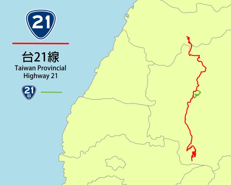
Taiwan Provincial Highway No. 21 is a Provincial Highway in Taiwan that begins Tianleng (天冷), Dongshi District, Taichung City, at the intersection with Provincial Highway No. 8 (Central Cross-Island Highway), and ends at Tataka(塔塔加), where it is connected with Provincial Highway No. 18 (New Central-Crossing Highway) in Yushan National Park. It is the primary highway to the Sun Moon Lake, a popular tourist destination. The total length is 145 km.
Contents
Map of Taiwan, %E5%8F%B021%E7%B7%9A
A southern segment of the highway became Provincial Highway 29 in 2014. The segment was from Namaxia to Linyuan in Kaohsiung City, and ran along the Cishan River(旗山溪) as well as the Gaoping River(高屏溪). The road that connects both segments between Tataka and Namasia is not built due to environmental and ecological issues.
Route
Provincial Highway No. 21 begins at Dongshi District, Taichung City, then passes through Guoxing, Puli, Yuchih, Sun Moon Lake, Shuili, Xinyi, and ended in Tataka. Its length is 149.126 km.
The highway is a part of Fengpu Highway (豐埔公路) that runs from Fengyuan to Puli. The segment from Puli to Sun Moon Lake is a part of Zhongtan Highway (中潭公路), which connects downtown Taichung with the lake. The segment from Sun Moon Lake to Tataka is a part of the unfinished New Central Cross-Island Highway (新中橫公路). The cross-island highway plan was formally abandoned due to environmental concerns.
Branch Line
The only branch line is named as Provincial Highway No. 21A, which is around the east side of Sun Moon Lake in Yuchih, Nantou County. Its length is 20.792 km.