
Peak Maja Jezercë, Albania Highest point Maja Jezercë Parent range Dinaric Alps | Elevation 2,694 m (8,839 ft) Country Albania | |
 | ||
Countries Albania, Kosovo and Montenegro Mountains Maja Jezercë, Đeravica, Maja Harapit, Zla Kolata, Maja Bojs Similar Maja Jezercë, Lake Skadar, Dinaric Alps, Đeravica, Bjelasica | ||
Prokletije (Serbian Cyrillic: Проклетије, [prɔklɛ̌tijɛ]; Albanian: Bjeshkët e Namuna; both translated as "cursed mountains"), also known as the Albanian Alps (Alpet Shqiptare) and the Accursed Mountains, is a mountain range on the western Balkan peninsula, extending from northern Albania to Kosovo and eastern Montenegro. Its peak in Albania, Maja Jezercë at 2,694 m (8,839 ft), is the highest point, and the 7th highest peak in Albania.
Contents
- Map of Albanian Alps Albania
- Name
- Location and relief
- Geology
- Massifs
- Canyons and valleys
- Rivers and lakes
- Highest peaks
- Climate
- Glaciation
- Flora
- Fauna
- Early climbing
- National Parks
- Settlement economy and transport
- Transport in Albania
- Literature
- References
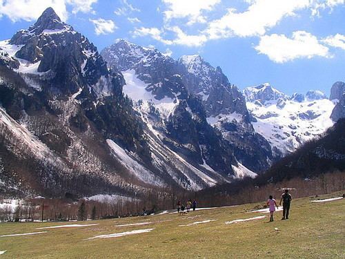
Map of Albanian Alps, Albania
Both the highest peak in Montenegro, Zla Kolata at 2,534 m (8,314 ft) (which is also partially in Albania) and the highest in Kosovo, Gjeravica at 2,656 m (8,714 ft), are here. The highest peak in Albania, however, is Mount Korab, part of the Korab range, at 2,764 m (9,068 ft) high and in the east of the country on the border with the Republic of Macedonia (making it Macedonia's highest point in addition).
The southernmost glaciers in Europe were recently discovered in the Albanian part of the range. The regional economy is based mainly on agriculture, immigrant remittances and tourism.
Name
Ptolemy mentioned Mons Bertiscus, which has been connected to Prokletije. Bertiscus lives on artificially in the form bertiscae in the scientific names for endemic species that have their locus classicus in the mountains, such as Valeriana bertiscae, Crepis bertiscae and Iris bertiscae.
Serbo-Croatian Prokletije and Albanian Bjeshkët e Namuna both mean "the accursed (mountains)", possibly because they are perceived as insurmountable and wild. In Albanian, another name for the mountain range since the 20th century is Alpet Shqiptare, meaning "Albanian Alps".
Location and relief
The Prokletije mountains, the southernmost part of the Dinaric Alps, stretch more than 40 miles from Skadar Lake along the Montenegrin–Albanian border in the southwest to Kosovo in the northeast. These points are at 42°45' and 42°15' N in the Mediterranean zone of the western Balkan Peninsula. The southern boundary of the Prokletije is found at the river Drin and its tributary Valbona. In a broader sense the Prokletije also include the mountain ranges to Kosovska Mitrovica with the Hajla and Mokna massifs. Some authors, however, see the river Lim as the northern boundary of the Prokletije in geological terms.
From Skadar lake, the mountains stretch northeast along the Cijevna river area, then curve slightly to the east in the direction of Gjeravica summit above Metohija (450m) basin in Kosovo. From here, the Prokletije turn northwards over the Bogićevića massif and Čakor pass, and continue with another row of mountains. The Prokletije finish in the area of upper Ibar river valley near the city of Kosovska Mitrovica, just after the Suva Planina (1,750 m) massif that encircles Metohija basin from the north and northwest.
The Prokletije are ethnographically and sociologically diverse due to many tribes living in the region as sheep herders. Names of various tribes - Hoti, Gruda, Kelmendi, Kastrati, Dukagjini, Shkreli, Shala, Nikaj, Krasniqi, Gashi and Rugova - refer to their geographical locations within the range.
Geology
The Prokletije are a subrange of the 1,000 km (621 mi) long Dinaric Alps. The Prokletije are a typical high mountain range with a pronounced steep topography and glacial features. Maximum relief differences of 1800 meters are found in the Valbona, Grbaja and Ropojani and Cijevna Valley. Overhanging walls and ridges forming pointed peaks are typical of the western and central Prokletije. The eastern mountains are less rugged with lower relief. The valleys show characteristic effects of Pleistocene glaciation. Most of the area was modified by glacial activity with karstic areas in the western parts.
The range was formed by the folding resulting from the collision of the African and Eurasian plates. Nowhere in the Balkans have glaciers left so much evidence of erosion. After the Alps, these mountains are the most glaciated in Europe south of the Scandinavian ice sheet. They have very steep limestone slopes with abundant karst features. The Prokletije is a large, rugged, pathless range. It is one of the rare mountain ranges in Europe that has not been explored entirely.
In some areas, the Prokletije run almost parallel with the Šar Mountains in Macedonia, Albania and Kosovo. This tectonic crash produced the unusual zig-zag shape of Prokletije range, and also their curving from the dominant Dinaric northwestern - southeastern direction toward the northeastern one. In the western and central parts of the range the composition of the mountains is of mainly uniform with Mesozoic limestones and dolomites of the Jurassic and Cretaceous ages. In the eastern Prokletije in addition to the limestone and dolomite series, there are rocks from the late Palaeozoic and Triassic periods, medium-Triassic volcanic rocks and Jurassic metamorphic rocks.
The Kalktafel of Prokletije is cut deeply with valleys in a variety of rock blocks of the mountains north of Përroi i Thatë, the Biga e Gimajive south of it, the Jezerca block between Shala and Valbona valley, the massif of the Maja e Hekurave, the plateau of the Maja e Kolats north of Valbona and Shkëlzen northeast of Valbona. The valleys were formed by Ice Age glaciers, which created very steep walls and hollows up to 1000 meters deep. The south wall of the Maja Harapit is 800 meters high, making it the highest rock face on the Balkan Peninsula.
Although some scientific research gives the Prokletije the status of a separate mountain chain, in most other ways this chain is still considered the highest of all Dinaric areas, connected with the Dinaric mountain chain in terms of geology, morphology, and ethnography.
Massifs
The Prokletije itself are made up of many large sections or mountain massifs/groups, all of which are connected to one another. These massifs include the Popluks group with a height of 2,694 m, the Shkurt group at 2,554 m, the Radohimës group at 2,570 m, the Zaborës e Krasniçës at 2,625 m, the Bjelic group at 2,556 m, the Karanfili-Brada group at 2,554 m, the Rabës group at 2,232 m, the Ershellit group at 2,06 6m, the Kakinjes group at 2,359 m, the Shkëlzen group at 2,407 m, the Bogićevica group at 2,533 m, the Horolac group at 2,199 m, the Kershi Kocaj group at 2,399 m, the Maja e Zezë group at 2,400 m, the Lumbardhit group at 2,52 2m, the Kopranik group at 2,460 m, the Strellc group at 2,377 m, the Gjeravica group at 2,656 m, the Junik group at 2,296 m, the Starac-Qokorr group 2,426 m, the Hajla group at 2,403 m, the Stedim-Ahmica group at 2,272 m, the Zleb-Rusulija group at 2,382 m, the Mokna group at 2,155 m and the Suva Planina group at 1,750 m.
Canyons and valleys
The erosion of the Prokletije mountains by glaciers left many telltale features behind. Deep river canyons and flat valleys wind around the ridges of the mountains. The largest and most popular canyon is Rugova Canyon. It is situated in Kosovo and is 25 km (16 mi) long from the border with Montenegro to the city of Peć and is 1,000 m (3,281 ft) deep. It has very steep vertical mountain slopes on both sides.
Valleys common at lower altitudes are also found at the alpine level, creating mountain passes and valley troughs. The most well-known valley to be high up in the mountains is Buni Jezerce in Albania. Buni Jezerce means "Valley of the Lakes" and it contains six small glacial lakes, the biggest being called the Big lake of Buni Jezerce.
Canyons in the Prokletije
Valleys in the Prokletije
Rivers and lakes
The Prokletije include many of the important rivers of the southeastern part of the Western Balkans. Rivers in this range fall roughly into two main categories, those that flow into the Lim and those that enter the White Drin and meet the Black Drin downstream at the Drin confluence. The southern and eastern slopes of Prokletije fall into the latter category.
The Tara and Lim rivers, two major sources of the Dinaric river system, originate on the northern borders of the Prokletije. The Vërmosh originates in the northwest mountainous part in Montenegro, close to the border with Albania. As a tributary of the Drina it drains into the Danube and then into the Black Sea. The Lim flows through the Plav lake. The Ibar, which originates on the slopes of the Hajla, takes a similar route into the Danube via the West Morava in Serbia.
In the southern Prokletije, the Drin dominates. It drains most of the ranges with its tributaries and when measured from the source of the White Drin in Radavc to the mouth of the Drin near Lezha, it is 335 km long. However, not all of the Drin flows near or parallel to the Prokletije. One Drin tributary is the Valbona, which drains into the Adriatic Sea, and its eastern tributary the Gashi River. To the west of the Prokletije is the Cijevna, which drains the northwestern part of the Montenegrin-Albanian border area to the Adriatic. Water levels fluctuate due to the karst hydrological drought in the Prokletije. Some rivers or streams, such as Përroi i Thatë in Albania, dry out completely during the summer droughts. Although the Pećka Bistrica in Kosovo is short, it is very powerful and carved the Rugova Canyon.
There are about 20 small alpine lakes of glacial origin in the Prokletije. Many lakes are in the Bogiçevica border area between Kosovo and Albania and the Buni i Jezercë trough near the Jezerca and Bojs peaks. Some lakes, such as Liqenat Lake in Kosovo and Hrid Lake in Montenegro, have become tourist attractions due to their locations and scenery.
Hrid Lake today is a clear example of a well-preserved glacial relief. In the Pleistocene period (1.8-0.01 million years ago) this was a collection area for ice that fell down over steps of rock from surrounding peaks, dragging with it heterogeneous material. Precipitation washed away smaller rocks, but larger ones remain on the southwestern and western lake shore. The lake is 295 meters long, 110 meters wide and about 5 meters deep on average. In addition to precipitation, it receives water from sources near its shores.
The largest lake is Lake Plav in Montenegro. The lake lies at an altitude of 906 meters above sea level in the Plav valley, nestled between the Prokletije and the Visitor range. The surface area of Lake Plav is 1.99 square kilometers and it extends north-south for some 2,160 meters.
Waterfalls are also found in some parts of the range. The White Drin Waterfall in Kosovo reaches a height of 25 m (82 ft). Because it is not far from the city of Peć, it is easily accessible and frequented by many visitors. The Grunas Waterfall in Albania is 30 m (98 ft) high and is in the Thethi National Park. The Ali Pasha natural springs in Montenegro near the town of Gusinje are the premium attraction for the town.
Highest peaks
Peaks over 2,600 m (8,530 ft)
Peaks over 2,500 m (8,202 ft)
Peaks over 2,400 m (7,874 ft)
Peaks under 2,400 m (7,874 ft)
Climate
The Prokletije is on the whole the wettest area of Europe. In the village of Boga in the dry valley, precipitation is 3,033 millimetres (119.4 in) per year, and otherwise 2,000 to 2,500 millimetres (79 to 98 in) per year is normal. At higher elevations snow is found even in summer, except in very dry years. In winter some villages in the Albanian part of the Prokletije are completely cut off from the rest of the world for months due to the very heavy snow.
Glaciation
Today (as around 2015) on the shady northern slopes of the Prokletije, there are at least five active glaciers that probably formed during the late Holocene period, and some inactive glaciers between 1,980 and 2,420 meters high. The trough valleys of Ropojani, Grbaja and Valbona were carved by miles of glaciers during the last Ice Age. Detailed geomorphological mapping was used to reconstruct the positions of former glaciers. The longest glacier of Ropojana had a length of 12.5 kilometres (7.8 mi) and a surface area of 20 square kilometres (7.7 sq mi); others include Valbona glacier at 9.5 kilometres (5.9 mi) and 10.5 square kilometres (4.1 sq mi), Grbaja Glacier at 5 kilometres (3.1 mi) and 6.7 square kilometres (2.6 sq mi) and Bogićevića Glacier at 6 kilometres (3.7 mi) and6.9 square kilometres (2.7 sq mi). In addition about 20 small lakes of glacial origin are found as described above, among them the lake group Buni i Jezerce to the north side of Jezerca, the Ridsko Lake, Lake Bukumisko and Rikavacko Lake.
A recent report from geographers at the University of Manchester details the discovery of four previously unknown glaciers in the Albanian part of the Prokletije range at 1980–2100 m high, found in the area close to Maja e Jezerces. The glaciers, the largest of which is currently the size of six football pitches, vary in size every year according to the amount of winter snowfall and temperatures during the following summer. Their average total surface area is 5 hectares (0.019 sq mi). Glacier-climate modeling suggests that these glaciers require annual accumulation of between 4,137 and 5,531 millimetres (162.9 and 217.8 in) (rainfall equivalent) to balance melting, which would correspond to between 49.7 and 66.4 metres (163.1 and 217.8 ft) of snow. A significant proportion of this accumulation is likely to be sourced from windblown snow and, in particular, avalanching snow. It is estimated that the total accumulation needed to balance melting is potentially up to twice the amount accumulated from direct precipitation. The presence of these glaciers, the southernmost in Europe, at altitudes well below the regional snow line highlights the importance of local controls on glacier development. The geographers think at least eight glaciers were present in neighbouring mountains during the 19th century, correlating with the culmination of the 'Little Ice Age' in the European Alps.
Flora
The vegetation of the Prokletije is among the richest on the Balkan Peninsula and one of the main central European regions for flora. To date, 1611 wild plants have been described in the Albanian part alone. In total, 50 flora species are endemic, sub-endemic and endangered plant species. The southern edge of mountains have a sub-Mediterranean character. Various evergreen bushes are found in the deepest valleys of the canyons and sunny slopes, and in the higher valleys deciduous Shibljak shrubs are common. In the mountains over 100 medicinal herbs are found, including species of the genus Primula, Satureja and Sideritis. Because of its altitude and its favored habitat, the range is one of the centers of arcto-alpine relict flora of the Balkan Peninsula. Out of 77 arcto-alpine species of former glacial flora on the Balkan Peninsula, a little over 50 species can be found in the Prokltije.
The levels of vegetation in Prokletije meet the alpine level, from upland valleys through the montane mountain stage on forest-free alpine and subalpine mats and subnivale tundra caused by permafrost in vast heaps of rubble with raw soils. A real snow level is not widely spread, although in the high altitudes snow and fern fields can also keep during the summer on four very small glaciers at high altitudes, the highest one found in the shade of Jezerca.
Beech, fir and silicate spruce forests dominate the mountain areas. These forests of beech Fagus sylvatica consist mostly of white fir. Rarely, however, the Northern Europe species are found, typically the Scots pine Pinus sylvestris. The drought-resistant Mediterranean-sized black pine Pinus nigra is also common. Aspens Populus tremula grow in damp sites alongside mountain maple Acer pseudoplatanus and Norway spruce Picea abies. The Prokletije is one of the southernmost areas where spruce grow in Europe. The "combat zones" of the forest are formed with dense thickets of mountain pine Pinus mugos. Conifers like the snakeskin pine Pinus heldreichii are on carbonate rocks and the Macedonian pine Pinus peuce of silicates are typical elements of the endemic Balkan flora. These are of special interest for natural history.
A cushion-sedge and blue grass lawn of Seslerion juncifoliae grows in alpine areas and, on shallow limestone soils, Oxytropidion dinaricae, to which the alpine grass krumm grows as in the Alps. Other plants include Alpine aster Aster alpinus, edelweiss Leontopodium alpinum and white mountain avens Dryas octopetala. These plants are atypical alpine plants specially adapted to the short growing season, UV radiation, cold and thin soils.
The flora in the rocky areas of the Prokletije are particularly noteworthy, because they are rare rich and endemic species, including the Tertiary relic Amphoricarpos neumayeri. Many species of flora are either endemic or are mainly found in the Prokletije. A plantain plant Plantaginaceae is found in the central Prokletije as a variant of the alpine Wulfenie, but 700 km away it does not grow. Petasites doerfleri is only found on the Jezerca peaks, and the Albanian lily Lilium albanicum and Viola ducagjinica are only found at the top of the Maja Radohimës slope. Also noteworthy is the Viola vilaensis Hayek. Viola chelmea belong to a violet species that occur on the Montenegrin-Albanian border area, especially at the lake Bukumirsko Jezero at 2,100 meters, and are only found on Asia Minor and the Balkans where they can grow due to woody, robust rhizome, cleistogamous flowers, and a lack of foothills. The Prokletije is also the only European area where the Tertiary relic Forsythia europaea grow.
Fauna
Large mammal species that have long been extinct in other regions are found here, such as the Eurasian brown bear, grey wolf, red fox, European wildcat, roe deer, fallow deer, red deer, wild boar and European otter.
The highly endangered Balkan lynx, a subspecies of the Eurasian lynx, is mainly found in the Thethi National Park where about roughly 20-50 individuals still roam, though poaching is still a large threat. Chamois are found throughout the high altitudes. About 720 chamois live between the borders of Kosovo and Montenegro alone. There is speculation that the mouflon roamed the Prokletije until World War I, when it disappeared.
Bird species include the golden eagle, snake eagle, honey buzzard, peregrine falcon, capercaillie, rock partridge, scops owl, Eurasian eagle owl and the snow finch.
The rivers are home to a growing number of marble trout. Among the amphibians are the alpine salamander (southernmost habitat), fire salamander, yellow-bellied toad and fire bellied toad . The rich herpetofauna include the fence lizard, green lizard, Greek tortoise and snakes such as the true vipers, including the poisonous horned viper and adder.
So far 140 species of butterflies have been found, which makes Prokletije the richest area in Europe for butterflies. The Prokletije have one endemic species of lizard, the Prokletije rock lizard or Dinarolacerta montenegrina, named after the range.
Early climbing
British climbers Sleeman, Elmalie and Ellwood were the first to reach the summit of Maja Jezercë on 26 July 1929. Years later Austrian mountaineers also scaled the summit. Many explorers and scientists have visited the Prokletije, collecting rocks and samples to display in museums.
Before any of these expeditions, the highest peak of the range was believed to be Shkëlzen at 2,407 m (7,897 ft) high, followed by Maja Radohimës at 2,570 m (8,432 ft). By early summer 1929 all the summits were measured by Italian geodetes.
National Parks
There are three national parks in Prokletije—one in Montenegro and two in Albania. A fourth national park has been proposed for Kosovo. The Theth National Park in Albania was designated in 1966 and covers an area of 2,630 hectares along the Thethi River. The main attraction in the park is the Grunas Waterfall. The Valbona Valley National Park in Albania was also designated in 1996 and covers 8,000 hectares including the Valbona Valley and the Valbona River. This park is also referred to as the Gem of Albania. Kosovo, Albania, and Montenegro are planning to create another tri-state park in the area, that will be called Balkanik Park of Peace.
There are plans to create the enlarged Albanian Alps National Park of Albania, which would include areas of Vermosh, Thethi, Valbona and Gashi River in a massive area of 86,000 hectares. The park on the Kosovar side would include an area of 50,000 hectares, covering the high alpine areas as well as the Rugova Canyon and important rivers. The Montenegrin part of the Prokletije range was declared a national park in 2009, comprising an area of 16.000 hectares.
A part of Maja e Ropës mountain was declared a floral mountain reserve in 1955, covering an area of 25 hectares of mainly Macedonian pine, pine and beech. In the same year the Kozhnjar area was declared a fauna reserve in particular to protect the chamois, covering an area of 161 hectares.
Illegal deforestation is still a major problem today. To some extent even the national parks are affected. In dry summers forest fires are common. All the large mammals including wolves, chamois, foxes, badgers and wild boar are hunted without regard to national park boundaries.
Settlement, economy and transport
The Proketije are home to Albanians, Montenegrins, Serbs and Bosniaks, but they are only very sparsely populated. At the edges there are some settlements: the Albanian Koplik and the Montenegrin Tuzi in the west near the Skadar Lake; Plav and Gusinje in of the northern valley of the upper Lim river in Montenegro and Bajram Curri, the main town of the district Tropoja, in the eastern Prokletije. Even the somewhat more distant, larger cities of Shkodra, Podgorica, Đakovica and Peć create their sphere of influence and are frequently visited by inhabitants of the highlands for errands, administrative procedures and market sales.
In the mountains themselves villages only have up to a few hundred inhabitants. They are often pronounced scattered settlements without a clear core. Among the biggest are likely to be Tamara and Selca, both in the valley of the Cem and belonging to the community of the Kelmend. The community of eight villages - including Vermosh - comprises 6,600 inhabitants. Tamara today is the only place in the central mountains with infrastructure such as a secondary school. Tamara and Vermosh share a maternity hospital. Until the collapse of communism there were such facilities, for example, in the Shala Valley. Many residents of the villages in the interior such as Boga, Theth or Valbona live only in the summer months there, as these villages are cut off for many weeks during winter.
In addition to the seasonal migration, the whole mountain area is suffering from a severe brain drain, as its only agriculture income is scarce. Many leave to seek work and a little more comfort in the region of Shkodra and Koplik, Tirana or abroad. As the year-round population dwindles as the terrain becomes less accessible, there are few state or local government employees such as teachers. Local income comes from agriculture, semi-illegal forestry and tourism.
In a few places like Theth tourism has been revitalized by recreational hiking. With the help of GTZ, 40 private houses (also referred to as guest houses, or han in Albanian) have been transformed into tourist accommodations or B&Bs. In 2010 there were 130 beds available in total - 100 more than in 2007. Additionally, hiking trails have been marked and trails maps and travel guides published. In the period from 2006 to 2009, the number of tourists rose from 300 to around 7,500 per year. Unlike in the rest of Albania, the increase was due to foreign tourists. Lakes such as Plav and Hrid also receive many tourists during the summer months. In many villages there are small hydro power plants that supply the village with electricity.
Many villages were already settled by the 15th century, and some valleys have been inhabited since the Stone Age. At the end of communism, however, several thousand people emigrated and depopulated the area.
Transport in Albania
SH20 road crosses the Prokletije in the Kelmend region of northwestern Albania, stretching from the eastern shore of Lake Scutari at the Han i Hotit border crossing with Montenegro, to the first pass into the valley of Cem. It then leads to the source elevation of the Qafa e Predelecit after Vermosh, followed by another border crossing, ending at Gusinje. As of 2015 the SH20 stretch between Hani Hotit and Tamare has been paved and upgraded to European standards.
From west to east, there is only SH21 road recently paved from Koplik to Boga, while from Qafa Thores leading to Theth the road is still under construction and in bad shape. From Theth, there is a bad track down to the Shala Valley Church and only a walking path along the river leads to Shkodra. SH22 road over the Qafa e Morinës at Bajram Curri after Đakovica has been reconstructed. In the past, the only route for crossing the border between Montenegro and Kosovo was via Rugova Canyon, which was very dangerous and steep. With the construction of the Peć–Rožaje highway the situation has greatly improved. In addition, SH42 road leading to Razem from SH21 has also been recently reconstructed.
Historically, a caravan route between Podgorica and Plav crossed the mountains along Lim and Cijevna.