
 | ||
Similar Seagrove Bay, National Trust ‑ St Helens D, St Helens Fort, Bembridge Windmill, Compton Bay | ||
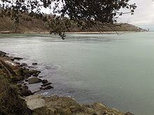
Priory Bay is a small privately owned bay on the north east coast of the Isle of Wight, England. It lies to the east of the village of Nettlestone. It faces east towards Selsey Bill and its shoreline is 600m in length. It stretches from Horestone Point in the north to Nodes Point in the south.
Map of Priory Bay, United Kingdom
The northern part of the bay has a straight coastline and is sandy with some pebbles. At the southern end the bay curves round to the east. Here the coast is rocky with evidence of walls and buttresses that were built to protect the coastline. These have largely been breached and lie scattered along the shore.
The bay is surrounded by woodland known as Priory Woods owned by the National Trust.
The sea bottom is predominantly sandy. A shallow sand bank called Gull Bank exists just offshore which keeps a long thin pool of water next to the beach at low tide. Beyond the bank the bottom is gently shelving.
The bay can be accessed by walking round Horestone Point from Seagrove Bay