
Population 716 (2001 Census) Civil parish Preston Brook Local time Sunday 3:08 PM | OS grid reference SJ5881 Dialling code 01928 | |
 | ||
Weather 16°C, Wind E at 21 km/h, 44% Humidity | ||
Preston Brook is a civil parish in the borough of Halton, a unitary authority in the ceremonial county of Cheshire. It is located to the south-east of Runcorn and south-west of Warrington, adjacent to the M56 motorway. It contains the villages of Preston Brook and Preston on the Hill.
Map of Preston Brook, UK
In the 2001 Census, the civil parish of Preston Brook had 312 dwellings and 716 residents. Approximately 3,000 people are employed in the area. Preston Brook has a small industrial park called Abbot's Park, formerly used by the mobile telephone company O2 and Wincanton Logistics, though it is now used by Scottish Power and Marks & Spencer, among others.
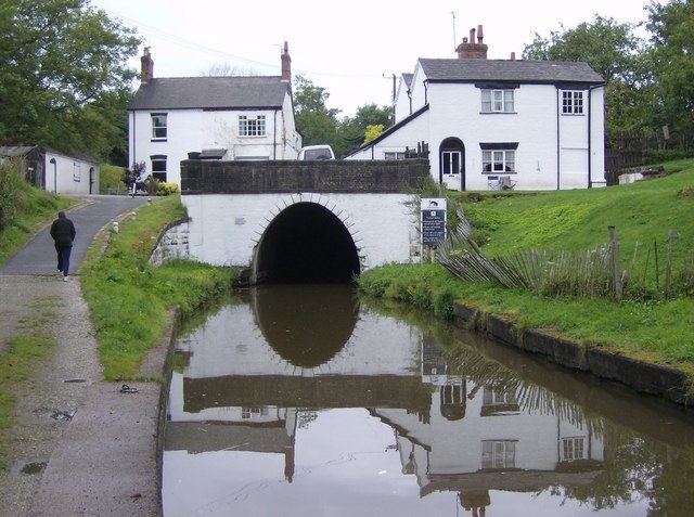
The Bridgewater Canal runs from Manchester through Preston Brook where it divides into two branches. One branch leads to Runcorn where it used to join the Manchester Ship Canal, and before that the River Mersey, while the other branch joins the Trent and Mersey Canal at the Preston Brook canal tunnel. The community has a website and a bi-monthly newsletter.