
 | ||
Preservation Inlet is the southernmost fjord in Fiordland National Park and lies on the southwest corner of the South Island of New Zealand.
Contents
Map of Preservation Inlet, New Zealand
Geography
A long narrow fjord extending north-eastwards between Gulches Head to the north and Puysegur Point to the south. Coal Island lies at the entrance. Its innermost arm is known as Long Sound which is the outlet of Long Burn. Gray River flows nearby the inlet.
A large part of the interior of Preservation Inlet is protected by the Te Tapuwae o Hua (Long Sound) Marine Reserve.
History
Known to early sealers and whalers, it was named by Captain Eber Bunker in 1809. The first shore-based whaling station in New Zealand was established here in 1828 or 1829, exploiting southern right whales in the area.
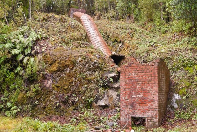
In the 1890s gold deposits were found. Two settlement known as Cromarty and Te Oneroa were established in Kisbee Bay for miners. However by 1904 only a few miners were left, and few traces of the settlements remain.
Fauna
After a massive exploitation for over years, southern right whales finally started returning into the inlet along with Chalky Inlet. There are anecdotal sightings of Hector's dolphins. while bottlenose dolphins are more regularly observed. Southern elephant seals are occasionally observed resting on shore around the inlet.
Access
No roads reach the coast at this point. However, a tramping track is available from Tuatapere. There is also access to the sound by sea or air.