Harman Patil (Editor)

Prague 10

Updated on
Edit
Like
Comment
Share on FacebookTweet on TwitterShare on LinkedInShare on Reddit
- elevation
  
273 m (896 ft)

Area
  
18.6 km²

- summer (DST)
  
CEST (UTC+2)

Prague 10 httpsuploadwikimediaorgwikipediacommonsthu

Prague 10 is both a municipal and administrative district in Prague, Czech Republic with more than 100.000 inhabitants.

Contents

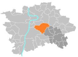
Map of Prague 10, Czechia

Neighbourhood (cadastral communities) of Prague 10

  • Vršovice
  • large part of Strašnice (except the block with Tesla Strašnice and part of Nákladové nádraží Žižkov, which fall within the city district Prague 3)
  • small part of Vinohrady (south and east from the streets Slovenská, U vodárny, Korunní, Šrobárova, U vinohradského hřbitova a Vinohradská)
  • large part of Malešice
  • part of Záběhlice
  • part of Michle (Bohdalec and the greater part of the Slatiny settlement)
  • small part of Žižkov
  • other small parts
  • Important Buildings

  • Hus' House (Vinohrady)
  • Trmalova Villa
  • Strašnice Crematory
  • Vršovice Castle
  • Vlasta Neighborhood
  • Vršovice Savings Bank Building
  • References

    Prague 10 Wikipedia


    Similar Topics