
Population (2008) 582 Area 38.16 km² | Time zone CET (UTC+1) | |
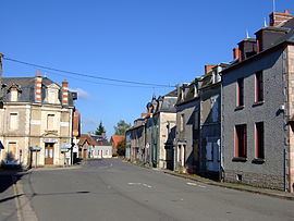 | ||
Préveranges is a commune in the Cher department in the Centre region of France.
Contents
Map of 18370 Pr%C3%A9veranges, France
Geography
A large farming area comprising the village and many hamlets situated by the banks of the small river Joyeuse, some 44 miles (71 km) south of Bourges, at the junction of the D10 with the D120 road. The commune is bordered to the south by the river Arnon. The commune borders both the departments of Allier and Creuse and is the highest point in the Cher department.
Sights
International relations
The commune is twinned with:
References
Préveranges Wikipedia(Text) CC BY-SA