
Surface elevation 318 m | Area 112.5 km² | |
 | ||
Location Grant County, Washington,United States | ||
Potholes reservoir fishing
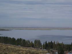
The Potholes Reservoir is part of the Columbia Basin Irrigation Project. It is formed by the O'Sullivan Dam and located in central Washington, in the United States. The reservoir is fed by water from Moses Lake, part of the Crab Creek basin.
Contents
- Potholes reservoir fishing
- Map of Potholes Reservoir Washington USA
- RecreationEdit
- FishingEdit
- References
Map of Potholes Reservoir, Washington, USA
The area features several lakes (typically 30-70 yards wide and 10–30 feet deep). These lakes, known as "potholes" were created through both natural and man made processes. The potholes were initially carved out during the Pleistocene by flood waters originating from Glacial Lake Missoula. Subsequent damming of the area by the Columbia Basin Project raised the water table high enough to allow these topographical depressions to become lakes.
Also known as:
RecreationEdit
On the shore of the reservoir is Potholes State Park, a 640-acre (2.6 km2) member of the Washington State Park System. It has 600 feet (180 m) of shoreline on the reservoir.
FishingEdit
There are many types of fish inside of the reservoir, including: