Country India District Kasaragod PIN 671533 | State Kerala Time zone IST (UTC+5:25) Vehicle registration KL-14 | |
 | ||
Similar Hosdurg Fort, Ananthapura Lake Temple, Veeramala Hills | ||
Posadigumpe
Posadigumpe is a hill in Kasargod district of Kerala state, south India.
Contents
- Posadigumpe
- Kasargod all eyes go high at kite festival on posadigumpe hill daijiworld television
- Tourism
- Languages
- Administration
- Access
- Transportation
- References
Kasargod all eyes go high at kite festival on posadigumpe hill daijiworld television
Tourism
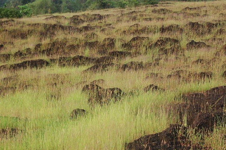
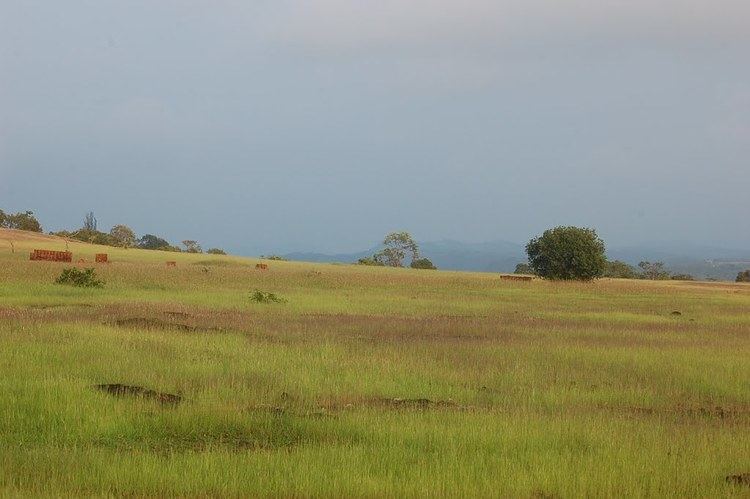
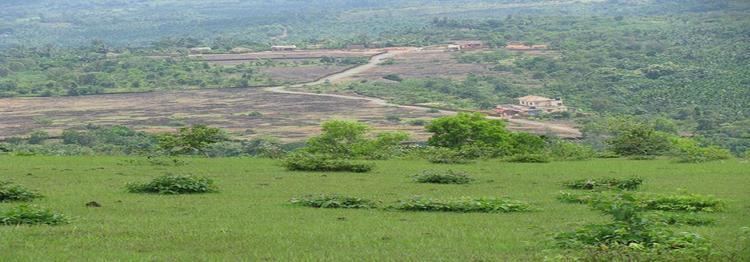
Posadigumpe is an ideal picnic spot and tourist resort located on a hillock 487.68 metres above sea level in Dharmathadka, 30 km north-east of Kasargod. From the hill top one can see the Arabian Sea, Manglore, Kudremukh, etc.
Languages
This locality is an essentially multi-lingual region. The people speak Malayalam, Kannada, Tulu, Beary bashe and Konkani. Migrant workers also speak Hindi and Tamil languages.
Administration
This village is part of Manjeswaram assembly constituency which is again part of Kasaragod (Lok Sabha constituency)
Access
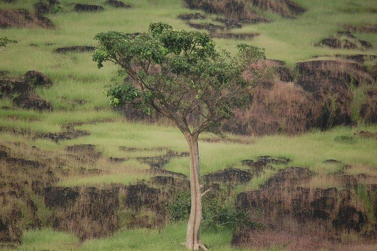
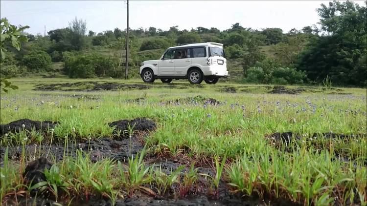
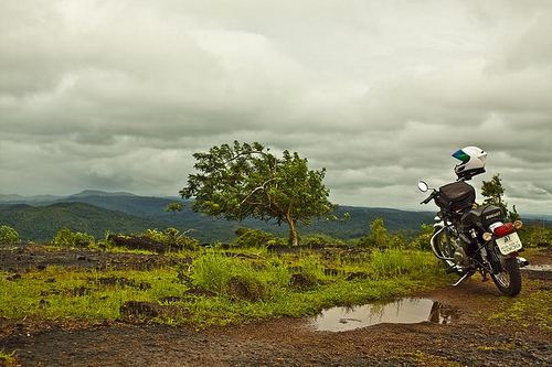
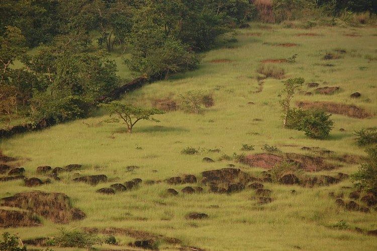
Ambiguity and discovery defines a trip to Posadigumpe, a low hill off National Highway 66 close to the Kasargod-Dakshina Kannada border that reveals majestic views of the hilly terrain in these districts. Though Posadigumpe is ideal as a quick drop-by after a visit to Bekal, it stands well on its own as the sole destination. The advantage is that while Bekal Fort will be crowded with tourists, Posadigumpe can afford silence, peace and privacy along with gorgeous views of rolling hills against the backdrop of the Western Ghats. How non-descript is this tourist spot? Scourging through the internet and government websites reveal only a two-line description: “An ideal picnic centre and tourist resort located on a hillock 487.68 metres above the sea level at Dharmathadka, 30 km north-east of Kasargod. From the hilltop, one can see the Arabian Sea, Mangalore, Kudremukh, etc.” Dharmatadka is on the base of the hill. Rusty directions point generally to a series of hills, but local people will help find the non-descript village of Posadigumpe. A narrow road gradually climbs up the face of the hill – sometimes offering intermediate views or a cooling envelop of thick woods around. The seemingly-never ending road ends with a sign that plainly reads “Posadigumpe” while ambiguously pointing off the road. While this leads to good view, the best are the ones that require a bit of trekking. Again here, local people would be the best guides. If not, then head towards the nearest peak, park the vehicle by the road and climb up indiscriminately. It should not take long to find a sheep trail among the shrubs from where a 20-minute walk leads up to the crest of the hill. During winter, the two-foot green grass dries up and shines golden against the setting sun. The flat surface is perfect to spread a mat and establish a picnic there. The jagged outline of the Western Ghats on one side and the ocean stretches out in a calm blue on the other are visible from here. It is advisable to watch the sun set from the road as though the view from the top is majestic, climbing down from the spot is difficult and possibly dangerous in the dark.
Transportation
Local roads have access to National Highway No.66 which connects to Mangalore in the north and Calicut in the south. The nearest railway station is Manjeshwar on Mangalore-Palakkad line. There is an airport at Mangalore.