
Country South Africa District West Coast Established 1863 Area code 022 | Province Western Cape Municipality Bergrivier Postal code (street) 6810, 6811, 6812 | |
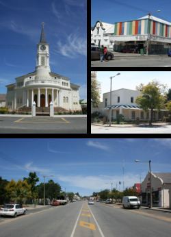 | ||
Porterville is a town in the Western Cape province in South Africa.
Contents
Map of Porterville, 6810, South Africa
Town at the foot of the Olifants River Mountains, 27 km south-east of Piketberg and 155 km north-east of Cape Town. It was laid out in 1863 on the farm Pomona, previously Willems Vallei, and became a municipality in 1903. It is situated 140 km north of Cape Town on R44 road at the base of the Olifants River mountains. Agriculture in the area is dominated by wheat production.
The town was established in 1863 and named after William Porter, Attorney General of the Cape Colony from 1839 to 1866.
Demographics
According to the 2011 census, Porterville had a population of 7,057 people in 1,949 households. 96.0% of the residents speak Afrikaans as their first language, while 1.9% speak English and 2.1% speak some other language. 76.4% of residents identified themselves as "Coloured", 21.0% as "White" and 1.6% as "Black African".