
Traversed by State Highway 73 Elevation 939 m | Location New Zealand Range Southern Alps | |
 | ||
Road New Zealand State Highway 73 Similar | ||
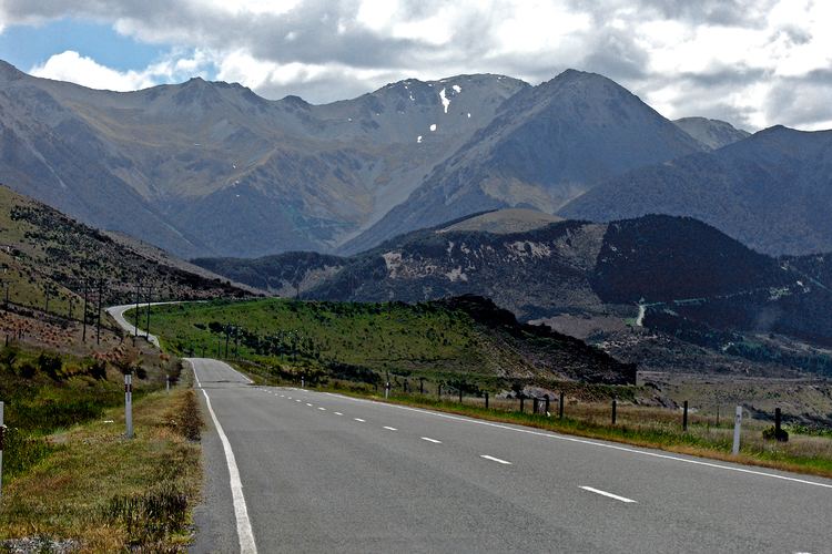
Porters Pass (elevation 939 metres) is a mountain pass in the Canterbury region of New Zealand's South Island.
Map of Porters Pass, Springfield 7580, New Zealand
It is near Lake Lyndon and is located within Korowai/Torlesse Tussocklands Park. State Highway 73 travels through the pass on its route from Springfield to Cass, and it is the last mountain pass on the route eastwards from Westland to Christchurch. It is also the third-highest point on the South Island's state highway network after the Lindis Pass and the Milford Road (though it is just one metre lower). Although Arthur's Pass is better known, Porters Pass is actually a few metres higher, and it affords views of the Canterbury Plains.
The pass was named in 1858 by the Porter brothers who were farming nearby.
References
Porters Pass Wikipedia(Text) CC BY-SA