
Size 45 hectares President and CEO Jim Quinn Annual revenue 13.7 million CAD (2009) | Opened Eighteenth century Available berths 13 Province New Brunswick Net income 773,000 CAD (2010) | |
 | ||
Location | ||
The Port of Saint John is a port complex that occupies 45 hectares (110 acres) of land along 3,900 m (12,800 ft) of waterfront of the Saint John Harbour at the mouth of the Saint John River in the city of Saint John, New Brunswick, Canada. The Port of Saint John, with facilities on both sides of the river, is noted for its extreme tidal range and river currents. Because of the semi-diurnal tides and the river influence, slack water occurs at approximately half tide and not at high or low water as at most other ports.
Contents
Map of St John Harbour, Saint John, NB, Canada
The port is administered by the Saint John Port Authority, a federal agency. Major products shipped through the port include oil, forest products and potash.
History
The location was first visited by Samuel de Champlain on his voyage of discovery to the New World in 1604, who described the Saint John River as “one of the largest and deepest we had yet seen” and who was advised by his Mi’kmaq guides that the river provided a route to the Saint Lawrence River valley with only a short portage. Because of its strategic location, it became the site of a French stronghold known as Fort La Tour. Though the fort was sacked in 1645, the river remained an important trade route for French, English and First Nations traders throughout the 17th and 18th centuries.
The port did not begin to develop in earnest until the influx of United Empire Loyalists in 1783. It developed rapidly as a result of timber trade and shipbuilding. Saint John became the province's leading industrial centre during the 19th century with much of the shipbuilding industry being concentrated on Courtney Bay outside the main harbour area. One of the best known ships built in Saint John was the Marco Polo (1851) which became renowned for its speed.
The Irish potato famine of 1845–1849 saw a large immigrant influx, and to handle the new arrivals, the government constructed a quarantine station and hospital on Partridge Island at the mouth of the harbour. The immigration station continued to operate for many decades. In 1859, Partridge Island also became known as the site of the first successful demonstration of an automated steam-powered foghorn, invented by the Scotsman Robert Foulis who had settled in the city. The foghorn is "ranked by historians as one of the most outstanding in the development of navigation aids."
For many years, the Port prospered as the winter port for Montreal. In 1889 the Canadian Pacific Railway opened a line across the state of Maine from Montreal to Saint John and transferred the majority of its trans-Atlantic passenger and cargo shipping to the port during the winter months.
During the First World War, the Port of Saint John became a trans-shipment point for the British Empire's war effort. It had less importance during World War II as the navy focus had been consolidated in Halifax.
The port suffered a decline following the opening of the St. Lawrence Seaway and the introduction of icebreaker services in the Seaway in the 1960s. In 1994 CPR left Saint John when it sold the line to shortline operator New Brunswick Southern Railway. The Canadian National Railway still services Saint John with a secondary mainline from Moncton.
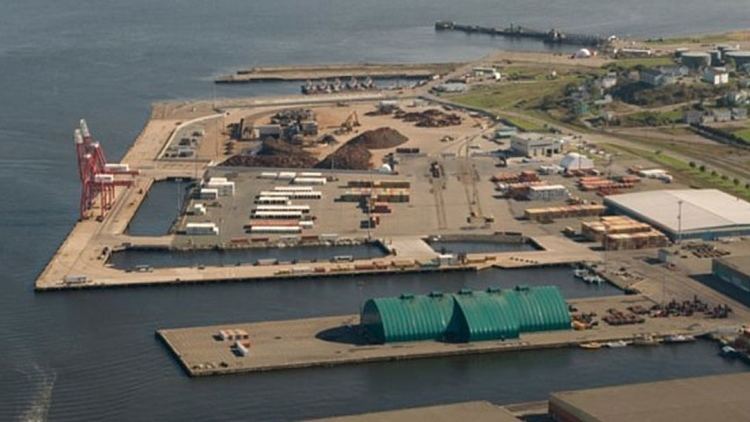
Port facilities
There are several marine facilities situated on either side of the harbour.
The west side of the harbour includes:
The east side of the harbour includes:
Former facilities: