
Country United States Time zone Central (CST) (UTC-6) Elevation 206 m Zip code 54865 Local time Friday 6:14 AM | Area 2.98 km² Population 164 (2010) | |
 | ||
Weather 1°C, Wind SE at 0 km/h, 100% Humidity | ||
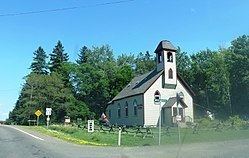
Port Wing (also Portwing) is an unincorporated census-designated place in the town of Port Wing, Bayfield County, Wisconsin, United States. The community is located on Wisconsin Highway 13, 30 miles (48 km) west of Bayfield. The Flagg River enters Lake Superior at Port Wing's harbor.
Contents
Map of Port Wing, WI 54865, USA
Population
As of the 2010 census, its population is 164. Port Wing has an area of 1.150 square miles (2.98 km2), all of it land.
Education
Port Wing is the site of South Shore School District.
Notable people
References
Port Wing, Wisconsin Wikipedia(Text) CC BY-SA