
Intercommunality Ouest Provence Area 73.38 km² Local time Friday 1:50 PM | Time zone CET (UTC+1) Population 8,530 (2007) | |
 | ||
Canton Port-Saint-Louis-du-Rhône Weather 14°C, Wind E at 16 km/h, 85% Humidity Points of interest Parc naturel régional, Plage Napoléon, La Ferme Du Tadorne | ||
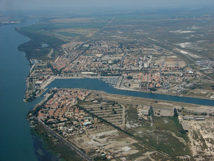
Port-Saint-Louis-du-Rhône is a commune in the Bouches-du-Rhône department in southern France.
Contents
Map of Port-Saint-Louis-du-Rh%C3%B4ne, France
History
The commune was created in 1904 from Arles and Fos-sur-Mer on which its history is dependent. The Saint-Louis channel was dug in 1871. The parish was established in 1886.
Features
Port-Saint-Louis-du-Rhône is an industrial town and port annex of Marseille at the mouth of the Rhône River, and includes many parks, large avenues and large farmhouses known as camarguais.
The town has three popular beaches: Napoleon beach, Olga beach, and Carteau beach.
There are many marshes and cultivated plans nearby, and vast salt-water marshes of the Camargue swamp.
Local wildlife includes herds of wild horses and pink flamingos being in the marshes.
Industry
The Camargue produces primarily salt and mineral oil. There are also petrochemical factories and grain mills.