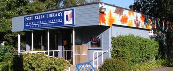
Province British Columbia | ||
 | ||
Port Kells is a neighbourhood of the City of Surrey in British Columbia, Canada, located at the northeastern end of that city adjacent to the Fraser River and west of the neighbourhood of Walnut Grove (part of the Township of Langley). It has two major components: a largely rural southern portion located to the South of Highway 1 and a northern section north of the Highway largely consisting of industrial estates.
Contents
Map of Port Kells, Surrey, BC, Canada
History
The Township of Port Kells was founded in 1889 by two Irish pioneers, both named Henry Kells, though unrelated. It was originally intended as a port and was laid out in 1890 by the Royal Engineers.
In the early 1960s, the Trans-Canada Highway was built through Port Kells and since the 1970s. The Highway has provided a neat distinction between the industrial northern portion and the rural and residential southern portion of the community.
Development
Development of the northern industrial portion occurred after 1970. The southern portion is slated to be developed into a mix of residential, commercial, and industrial uses from its present rural condition.
