
Population 121 (2006 census) Postal code 3964 Federal division Division of McMillan | Postcode(s) 3964 Local time Friday 8:17 PM | |
 | ||
Weather 18°C, Wind NE at 29 km/h, 80% Humidity | ||
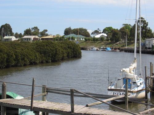
Port Franklin is a small fishing village 182 kilometres (113 mi) kilometres south-east of Melbourne in Victoria, Australia. It is about 2 km inland from the coastline of Corner Inlet. At the 2006 census, Port Franklin had a population of 121.
Map of Port Franklin VIC 3964, Australia
Port Franklin is situated on the banks of the Franklin River between Toora and Foster. The river is lined with small commercial fishing boats, privately owned pleasure craft as well as commercial charter vessels. The local community maintain the public hall, playground, tennis courts and parklands.
The Post Office opened around 1902, was known as Bowen until 1910 and closed in 1993.
References
Port Franklin, Victoria Wikipedia(Text) CC BY-SA