
Country United States County Boone Time zone CST (UTC-6) Area 61.75 km² Population 5,054 (2010) | State Illinois Settlement November 6, 1849 Elevation 275 m Local time Thursday 9:53 PM | |
 | ||
ZIP codes 61008, 61011, 61012, 61065 Weather 6°C, Wind SE at 24 km/h, 67% Humidity | ||
Poplar Grove Township is one of nine townships in Boone County, Illinois, USA. As of the 2010 census, its population was 5,054 and it contained 1,785 housing units. Poplar Grove Township was formed from parts of Caledonia Township and Boone Township after 1921.
Contents
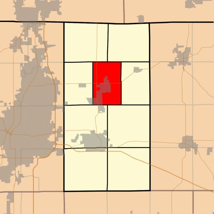
- Map of Poplar Grove Township IL USA
- Geography
- Cities
- Unincorporated towns
- Cemeteries
- Major highways
- School districts
- Political districts
- References
Map of Poplar Grove Township, IL, USA
Geography
According to the 2010 census, the township has a total area of 23.84 square miles (61.7 km2), of which 23.78 square miles (61.6 km2) (or 99.75%) is land and 0.06 square miles (0.16 km2) (or 0.25%) is water.
Cities
Unincorporated towns
Cemeteries
The township contains these five cemeteries: Clark, Ewins, Popular Grove, Russellville and South Poplar Grove.
Major highways
School districts
Political districts
References
Poplar Grove Township, Boone County, Illinois Wikipedia(Text) CC BY-SA