Pommern is an Ortsgemeinde – a municipality belonging to a Verbandsgemeinde, a kind of collective municipality – in the Cochem-Zell district in Rhineland-Palatinate, Germany. It belongs to the Verbandsgemeinde of Cochem.
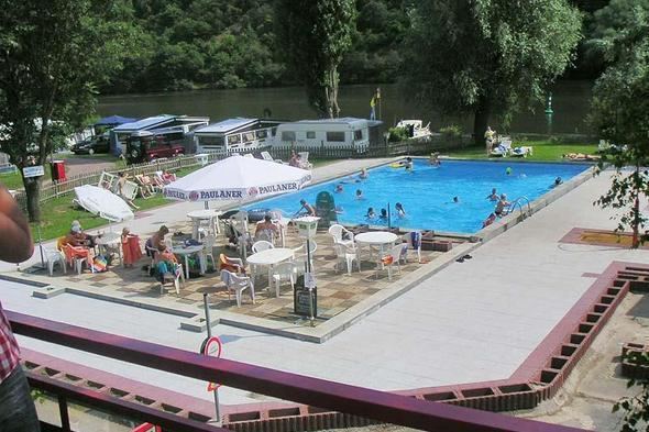
The municipality lies on the river Moselle’s left bank roughly 2 km upstream from Treis-Karden.
In 936, the municipality had its first documentary mention as Ponieries villa in a document from Otto I. Beginning in 1264, Himmerod Abbey was the biggest landholder in the village. Beginning in 1794, Pommern lay under French rule, and Himmerod Abbey was dissolved in 1802. In 1815 Pommern was assigned to the Kingdom of Prussia at the Congress of Vienna. Since 1946, it has been part of the then newly founded state of Rhineland-Palatinate.
The council is made up of 12 council members, who were elected at the municipal election held on 7 June 2009, and the honorary mayor as chairman.
The municipal election held on 7 June 2009 yielded the following results:
In 2004, the election was conducted by majority vote.
Pommern’s mayor is Paul-Josef Porten, and his deputies are Robert Schneiders and Ruth Mentenich.
The German blazon reads: Schräglinks geteilt, vorne in Silber ein schrägrechter roter Sparrenbalken, von roten Schindeln begleitet, hinten in Rot zwei ineinanderhängende goldene Ringe schräglinks übereinander.
The municipality’s arms might in English heraldic language be described thus: Per bend sinister argent semée of billets a bend dancetty gules and gules two annulets interlaced bendwise sinister Or.
The bend dancetty (diagonal zigzag) and the billets (little rectangles) are charges drawn from arms once borne by “Hans von Pumere” and bearing the yeardate 1368, as recorded in a tapestry at Burg Eltz, a local castle. The annulets, or rings, are a charge borne by the former Himmerod Abbey, who had the biggest landholdings in Pommern. The first vineyard was transferred to the Abbey as early as 1234 by Arnold von Braunshorn. By the 18th century, the Abbey still held responsibility for the church building, as it drew the whole tithe; in 1786 the Abbey built a new, Early Classicist church. The rectory that stands today, the former Himmeroder Hof, is said to be the “loveliest rectory in the Diocese of Trier”.
The arms have been borne since 1981.
The following are listed buildings or sites in Rhineland-Palatinate’s Directory of Cultural Monuments:
Saint Stephen’s Catholic Parish Church (Pfarrkirche St. Stephan), Bahnhofstraße 25 – separate Early Gothic tower, late 15th century; Baroque aisleless church, 1785; warriors’ memorial, Archangel Michael; baptismal font, 13th century; whole complexAm Kapellenberg 1 – Late Gothic solid building, essentially from the 16th or 17th centuryAm Spilles 2 – former inn; big slate quarrystone building, half-hipped roof, marked 1859, and a plastered building, 1885, ballroom with music gallery, front gardenAm Spilles 3 – former school; three-floor quarrystone building, mid 19th centuryAm Spilles/corner of Hauptstraße – walled gardenBahnhofstraße 2 – 15 hearth heating plates and border stones, 17th and 18th centuriesBahnhofstraße 3 – winemaker’s villa; Late Historicist quarrystone building, partly timber-frame, 1910; whole complex of buildings with commercial wingBurgstraße 142 – former Archiepiscopal Castle House; residential tower, later than 1414Friedhof – graveyard cross, mid 19th century; base of the Marquet tomb, latter half of the 19th century; grave cross, 20th century; whole complexHauptstraße – wooden sculpture, 18th or 19th centuryHauptstraße 2 – Late Gothic plastered building, 15th or 16th century, partly with timber framing from the 18th centuryHauptstraße 25 – winemaker’s villa; quarrystone building, about 1920; winepress house behindHauptstraße 26 – winemaker’s villa; Late Historicist quarrystone building, partly timber-frame, 1910; whole complex with commercial wingHauptstraße 13/15/17, 19, 21/23, 16, 18/20, 22, 24 (monumental zone) – quarrystone buildings with spire lights characteristic of the village expansion in the early 20th century, about 1910/1920Im Brauweiler 1 – Baroque round niche, inside a sandstone sculpture from the 16th or 17th century; grave cross, marked 1576Lindenstraße 11 – timber-frame house, partly solid, half-hipped roof, 18th centuryLindenstraße 114 – timber-frame house, partly solid, mid 17th centuryMoselweinstraße 13 – winemaker’s villa; Late Historicist quarrystone building, partly timber-frame, Moselle style, about 1900/1910Zehnthofstraße 1 – winemaker’s house; quarrystone building, latter half of the 19th centuryZehnthofstraße 4 – winemaker’s house, marked 1878Zehnthofstraße 5 – rectory, former Himmeroder Hof; two-winged building from 15th to 18th century, essentially Late Gothic, expanded in Baroque times; Classicist outer doorway, marked 1786Zehnthofstraße 6 – timber-frame house, partly solid, 18th centuryZehnthofstraße 8 – timber-frame house, partly solid, half-hipped roof, marked 1740, essentially possibly older; arch on the side, marked 1564Zehnthofstraße 9 – Electoral high court, former manor and courthouse; plastered building, 1785Zehnthofstraße 14 – three-floor timber-frame house, partly solid, marked 1623 and 1828 (conversion)Zehnthofstraße 20 – Electoral-Trier Amtshaus; three-floor timber-frame house, partly solid, stone staircase, marked 1585, half-hipped roof, 17th centuryZehnthofstraße 26 – hearth heating plate, 16th century, 1732; cast-iron coat of arms; hand pumpZum Daupes 1 – timber-frame house, partly solid, plastered, steep half-hipped roof, 17th centuryOn Bundesstraße 49, going towards Karden – Olligs-Heiligenhäuschen (Heiligenhäuschen: a small, shrinelike structure consecrated to a saint or saints), Wayside Chapel to the Holy Trinity (Wegekapelle Zur Heiligen Dreifaltigkeit); partly timber-frame, marked 1712; three high reliefs, 17th century; Baroque statuaryIn the vineyard – sundial, high rectangular tabletWay of the Cross with Mount of Olives Chapel – chapel, Gothic Revival plastered building; altar table, eight Gothic Revival figures, pietà; 14 Stations of the Cross, Ölbergkapelle (Mount of Olives Chapel) and Bildstock type with relief, late 19th centuryMartberg – Gallo-Roman area, protected zone against diggingBeside the fourth Station of the Cross – basalt wayside cross, marked 1674North of Pommern – wayside cross with pedestalEast of Pommern in the vineyard – basalt wayside cross, marked 1587Spillesfest: (winemaker’s chapel summer night festival): WhitsunKirmes (parish fair): first weekend in AugustWinzer-Hof-Fest (“Winemaker’s Estate Festival”): third weekend in SeptemberUferrock Open Air Festival: JulyEconomy and infrastructure
Within the municipality of Pommern lie the vineyards of Pommerner Rosenberg, Pommerner Sonnenuhr, Pommerner Goldberg and Pommerner Zeisel.
The name “Pommern” is also the name for Pomerania in German.