
Highest point Psilo Vouno Postal code 840 00 Elevation 370 m Max length 6 km | Highest elevation 370 m (1,210 ft) Population 0 (2001) Area code(s) 228x0 Area 18 km² | |
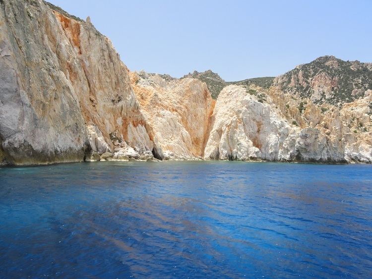 | ||
Galazia nera ilha de poliegos polyaigos pr xima a milos gr cia
Polýaigos (Greek: Πολύαιγος) is an uninhabited Greek island in the Cyclades near Milos and Kimolos. It is part of the community of Kimolos (Κοινότητα Κιμώλου). Its name means "many goats", since it is inhabited only by goats.
Contents
- Galazia nera ilha de poliegos polyaigos pr xima a milos gr cia
- Map of Polyaigos Kimolos 840 04 Greece
- Polyaigos trelli paralia aug 2009
- References
Map of Polyaigos, Kimolos 840 04, Greece
Along its longest axis, it is 6 kilometres (4 mi) and among its shortest 4.3 kilometres (3 mi) wide. It has a surface area of approx. 18 km2 (7 sq mi) and a coastal length of 22 to 27 kilometres (14 to 17 mi). It is very close to the island of Kimolos (2 km (1 mi) north west from Polyaigos) and to the island of Milos (6.2 km (4 mi) west from Polyaigos). There are two mounts, Stroggylo which rises to 330 metres (1,083 ft) and Psilo Vouno (370 metres (1,214 ft)).
The island is to a great extent privately owned by the Greek Orthodox church, which sublets parts of it to local herdsmen from the nearby islands of Milos and Kimolos.
Its goat population maintains Polyaigos as a barren island. It has, however, some magnificent beaches, mainly on the southern part of the island, as well as many sea-surface caves, which serve as a refuge to a dwindling population of Mediterranean monk seals (Monachus monachus).