
Prominence 1,715 m (5,627 ft) Elevation 2,267 m Mountain range Apennine Mountains | Parent range Lucan Apennines Province Province of Cosenza Listing Ultra-prominent peak | |
 | ||
Similar Sierra Dolcedorme, Monte Pollino, Serra del Prete, Cadena Costera, Monte Alpi | ||
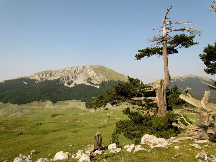
The Pollino (Italian: Massiccio del Pollino) is a massif in the southern Apennines, on the border between Calabria and Basilicata, southern Italy. It became part of the Pollino National Park in 1992. The main peaks include Monte Pollino 2,248 m (7,375 ft) and the massif's high point, Serra Dolcedorme 2,267 m (7,438 ft), which overlooks the plain of Sibari.
Contents
Map of Pollino, 87012 Castrovillari, Province of Cosenza, Italy
Geology
Formed from limestone, the Pollino is the highest area in the range and erosion of the limestone, especially on the Calabrian side, has created numerous grottoes, such as the Romito grottoes, in which Palaeolithic petroglyphs have been found. Canyons have also been carved into the limestone, such as the canyon created by the Raganello stream.
Wildlife
The Pollino is home to a flourishing fauna and flora. Woods dominated by chestnut, beech and the rare Bosnian pine, which is the park's symbol, cover especially the highest peaks; animal species include the Italian wolf, eagle owl, roe deer and the rare golden eagle.