
 | ||
Pole hill road 4x4 colorado
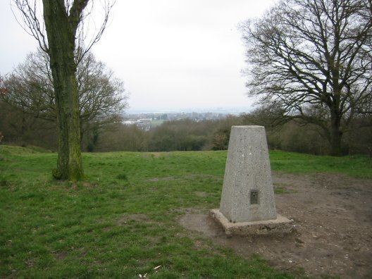
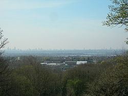
Pole Hill is a hill on the border between Greater London and Essex. From its summit there is an extensive view over much of east, north and west London, although in the summer the leaves of the trees in Epping Forest have a tendency to mask some of the view to the north and west.
Contents
- Pole hill road 4x4 colorado
- Urban legend flag pole hill
- Origin of name
- Astronomical history
- Famous connections
- References
Urban legend flag pole hill
Origin of name
The earliest recording of the name is as "Pouls Fee" or "Pauls Fee" in 1498. It is shown as Hawke Hill on the Chapman and André map of 1777. Hawke derives from the nearby Hawkwood. Hawk is the Old English for a nook, cranny or corner and so means wood at the corner of the parish (of Chingford.)
It was named Paul because it was in the manor of Chingford Pauli, also known as Chingford St. Paul's, which belonged to St Paul's Cathedral in London. Fee is from the Middle English fe which means a landed estate indicating it formed part of the manor. After the erection of the Greenwich Meridian obelisk mentioned below, it appears to have acquired the cognomen of Polar Hill, but this soon dropped out of use.
Astronomical history
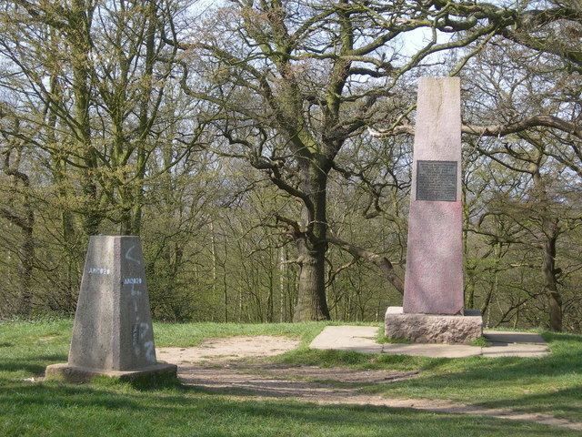
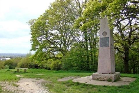
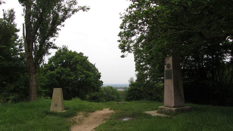
The hill stands in Epping Forest at 0 degrees longitude, and 51 degrees 38 minutes north latitude. At its highest point it is 91 metres above sea level. It is chiefly noted for the fact that it lies directly on the Greenwich meridian and, being the highest point on that bearing directly visible from Greenwich, was at one time used as a marker by geographers at the observatory there to set their telescopes and observation equipment to a true zero degree bearing.
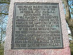
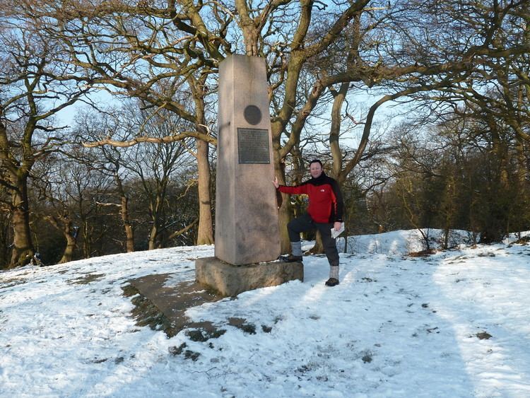
On the summit of the hill is an obelisk made of granite and bearing the following inscription:
This pillar was erected in 1824 under the direction of the Reverend John Pond, MA, Astronomer Royal. It was placed on the Greenwich Meridian and its purpose was to indicate the direction of true north from the transit telescope of the Royal Observatory. The Greenwich Meridian as changed in 1850 and adopted by international agreement in 1884 as the line of zero longitude passes 19 feet to the east of this pillar.
At that point (19 feet / 5.8m east) there is an Ordnance Survey trig point placed here to mark the top of the hill.
Famous connections
Lawrence of Arabia once owned a considerable amount of land on the western side of the hill and built himself a small hut there in which he lived for several years. Nothing remains today of this structure on Pole Hill. Lawrence's hut was demolished in 1930 and rebuilt in The Warren, Loughton.