
 | ||
The Pauquunaukit Wampanoag (anglicized as Pokanoket, literally, "land at the clearing" in Natick) is an indigenous group in present-day Rhode Island and Massachusetts. Prior to European colonization, the Pokanoket were the leadership of the groups that make up the modern-day Wampanoag Nation. However, ethnically Pokanoket groups and their neighbors did not begin to refer to themselves as Wampanoag until after King Philip's War, when Pokanoket identity was criminalized in Rhode Island and Massachusetts. Thus, while all Pokanoket are Wampanoag, not all Wampanoag are ethnically Pokanoket. The Pokanoket are the indigenous group in the first Thanksgiving story, although no meal was shared between the Pokanoket and English settlers and the former did not welcome colonization.
Contents
History
Prior to colonization, the political seat of the many bands that are collectively known as the Wampanoag Nation was located in the realm of Pokanoket, where one of the most significant historic sites is found on Mount Hope (Potumtuk, the lookout of Pokanoket in present-day Bristol, Rhode Island). At the time of the pilgrims’ arrival in Plymouth, the realm of Pokanoket included parts of Rhode Island and much of southeastern Massachusetts. Pokanoket social organization developed in a manner that differed from neighboring groups, since Pokanoket was more socially striated and politically complex. Archaeological excavations of Pokanoket burial sites indicate that wealth, such as wampum, was concentrated among a few individuals. European historic accounts of Pokanoket social life noted the political authority of the Massasoit (Great Leader). Unique to the Pokanoket was the spiritual and military elite known as the pniese (Pine E' See) who protected and served this Great Leader.
The realm of the Pokanoket was extensive and known to the Pilgrims before they arrived at Plymouth on the Mayflower in 1620. The leader of the Pilgrims, William Bradford, wrote of advice he had received before the Pilgrims sailed: “The Pokanokets, which live to the west of Plymouth, bear an inveterate malice to the English, and are of more strength than all the savages from there to Penobscot [in Maine]. Their desire of revenge was occasioned by an English man, who having many of them on board [a ship], made a great slaughter with their murderers and small shot, when (as they [the Pokanoket] say) they offered no injury on their part.” Sowams, consisting of modern-day Bristol, Barrington, and Warren, Rhode Island, was the main settlement of the Pokanoket when the Pilgrims arrived. Bradford had been told that the land of the Pokanoket had “the richest soil, and much open ground fit for English grain, etc.”, giving hint of the conflicts over land that would soon develop.
When the Italian captain Giovanni de Verrazano sailed into Narragansett Bay in 1524, indigenous people, most likely Pokanokets, appeared on the shores. The navigator’s recorded latitude of 41°40′ north corresponds to Mount Hope Bay, where the seat of the Pokanoket is located. Verrazano wrote of these Rhode Island natives whom he encountered: “These people are the most beautiful and have the most civil customs we have found on this voyage.”
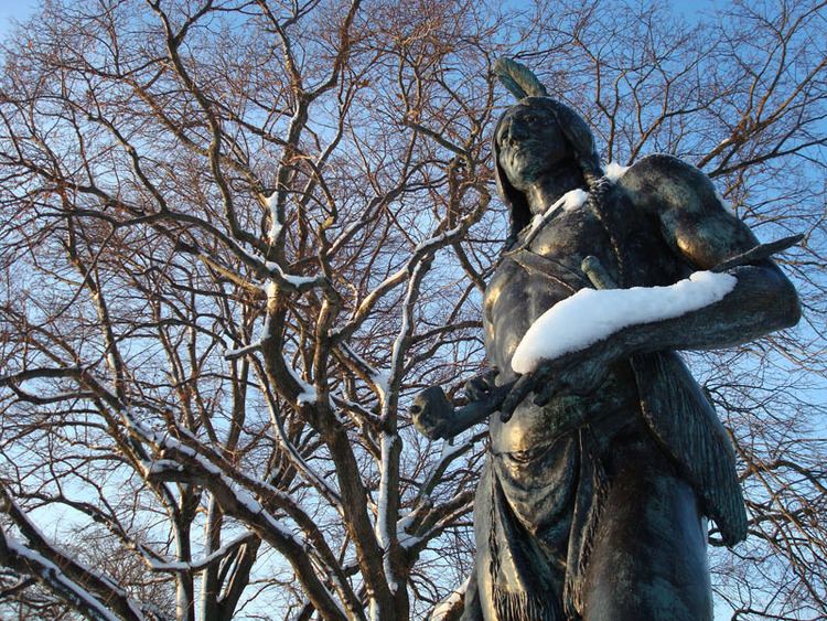
The Pilgrims lost more than half of their people due to sickness and starvation over the first winter. The Pokanoket felt sympathy for the Pilgrims' plight and began to teach them how to plant crops and live in this country. Despite the fears initially felt by the Pilgrims, the Pokanoket quickly reached a pact of peace with the new settlers. Bradford referred to the Pokanoket leader as “their great Sachem, called Massasoit”. It is not clear whether Bradford understood Massasoit to be a hereditary title rather than a name, and that confusion continued. When the Massasoit, whose name was Ousamequin, died, he was succeeded as Great Leader of the Pokanoket Nation by his sons, first by Wamsutta, who was perhaps poisoned, and then by Metacomet (also known as King Philip), who was killed in the Great New England War of 1675–1676. Neither son was referred to by the European settlers as Massasoit. The sons however, were known as kings during their time as Massasoits of the Pokanoket. Ousamequin had made peace with King James I of Britain, reaffirmed later in 1636, in which Britain had agreed through Governor Carver that forevermore Ousamequin's sons and his line would carry the royal titles of Prince or Princess. Ousamequin's request that his sons receive "English" names in Plymouth was granted, and they were given the name Alexander for Wamsutta, and Philip for Metacomet. Although the settlers did not call the Pokanoket leaders by the title Massasoit after Ousamequin died, they did refer to them as Kings, and the Great New England War was called King Philip's War by the settlers, named after Metacomet.
During this period, the Pokanoket first treatied with the English colonists of present-day Massachusetts. Continued tensions and encroachment by English settlements led to the outbreak of fighting in King Philip's War in 1675. The tribe did not sign the treaty that ended the war, Treaty of Casco (1678).
Natick, sometimes referred to as Pokanoket, is the dialect of Massachusett spoken among the Pokanoket. The last Pokanoket leader died in 1987.
Concerning repatriation
Native American spirituality is often misinterpreted and misunderstood. Traditional native spiritual beliefs encompassed both the natural and supernatural worlds. These beliefs originated and were grounded in a sense of place—the ancestral realm. Creation stories and explanatory myths were contextualized in the physical features of the natural environment. These traditional beliefs were not transportable to other environments and as tribes were relocated and their land was lost, so too were many aspects of traditional belief. Because of the physical changes that come with development, Native Americans cannot visit “the old country” to better understand past tradition and belief. It is essential, therefore, that tribally specific human remains, artifacts and funerary objects be respected and protected as cultural patrimony.
Ancient territory and boundaries
Pokanoket believe that their territory is an element of the Native American heritage that is their birthright, and that they are the stewards even of land which they do not legally own. The map featured here is a reconstruction of Pokanoket ancestral boundaries based on a political and topographical map from 1895, which itself drew on 17th-century topographical descriptions of political borders.
Map points
- Both the Seller Map and the Hack Map document Pokanoket ancestral land to the east and west of the head of what is now called Narragansett Bay.
- Pokanoket used rivers as boundaries for their ancestral lands due to the natural geographical features of their area. On the west side of the bay, the boundary starts in the land that is called Cowessett (Land at the border). The Pawtuxet River is the natural boundary that defines the border between the Narragansett and Pokanoket Tribes. Narragansett lands are to the south of the Pawtuxet River.
- Pokanoket lands lie to the north and northeast of the Pawtuxet River as far north as the Ponegunsett Reservoir, then continue northeast of the Ponegunsett Reservoir, northward up the Chepachet River.
- The Nipmuc lands are west and northwest of the Chepachet River. East of this river is Pokanoket lands.
- We now follow the Charles River from its basin northeasterly until it empties into Boston Bay. The lands to the west of the Charles River are Nipmuc lands. The lands to the east are Pokanoket lands.
- The lands north of the Charles River are Massachusetts lands and the lands south of the Charles River are Pokanoket lands.
- The eastern mainland boundary of Pokanoket is located at what is now the Cape Cod Canal, which was once a tributary extended from Great Herring Pond. West of this border is Pokanoket land. East of this natural border is the land of the Nausett.
- This leaves the islands in what we now call Narragansett Bay and the islands off the coast. All the islands in Narragansett Bay on this map are highlighted except for Jamestown and Dutch Island. These two islands belong to the Narragansett, as well as Block Island located in Rhode Island Sound.
- The highlighted islands on this map—Rhode Island (Aquidneck), Prudence, Patience, Hog and smaller islands—belong to Pokanoket. Also highlighted are Martha’s Vineyard, Nantucket, and No Man’s Land, as well as the Elizabeth Islands, which all belong to Pokanoket.