
 | ||
Similar Pointe de Pen‑Hir, Cap de la Chèvre, Îlot des Capucins, Presqu'île de Crozon, Tour Vauban | ||
The Pointe des Espagnols is the north-east extremity of the Roscanvel peninsula, an outgrowth of the Crozon peninsula closing off the roadstead of Brest. It also marks the south-east limit of the goulet de Brest (the other limits are marked by pointe des Capucins, pointe du Petit Minou and pointe du Portzic).
Contents
Map of Pointe des Espagnols, 29570 Roscanvel, France
Formed by a cliff that is more than 60m high, at whose summit and base are the remains of fortifications and barracks, the point reaches towards the north-east via the rocher de la Cormorandière, marked by a pole. The straight channel situated between the point and the rocher is the location for strong currents which affect the roadstead.
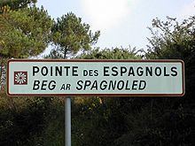
This strategic position, facing Brest, was already noted by the Duchy of Brittany, who sited a fortlet there in 1387 (now lost). In 1594, Spaniards landed here and were only dislodged after several battles - it was in this period that the cape first took on its present name.
Fortifications
The known works are: