
Population 31,351 (2011) | Area 11.65 km² Local time Wednesday 10:22 PM | |
 | ||
Weather 28°C, Wind E at 11 km/h, 76% Humidity Neighborhoods Polikandy, Thamanthoddam, Kanthiyoor Points of interest Point Pedro Lighthouse, Sakkotai - Point Pedro, Theru Moodi Madam | ||
Vanakkam thainadu ep 383 point pedro
Point Pedro (Tamil: பருத்தித்துறை Paruthithurai, Sinhalese: පේදුරු තුඩුව Peduru Thuduwa) is a town, located in Jaffna District, Sri Lanka, at the northernmost point of the island.
Contents
- Vanakkam thainadu ep 383 point pedro
- Map of Point Pedro Sri Lanka
- Sri top most point of sri lanka point pedro 2015
- Etymology
- Ancient history
- Portuguese history
- Dutch colonial history
- British colonial legacy
- Heritage sites
- Harbour
- Education
- References
Map of Point Pedro, Sri Lanka
Cotton is produced around Point Pedro in the fertile calcic red latosol soils. The eastern coast of Point Pedro forms a 3 mile wide, 20 mile long beach with sand dunes up to 100 feet high, extending to Thalayady. The porous soil has a water table deep underground with an estimated one billion litres of fresh water. The Boxing Day tsunami of 2004 raised the salt content of the ground water. The tsunami destroyed parts of the town and submerged some parts with seawater up to 4 feet deep.
The town came briefly under the control of the Tamil Tigers (LTTE) during the early 1990s, until the Sri Lankan Army recaptured it in 1995.
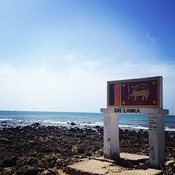
Sri top most point of sri lanka point pedro 2015
Etymology
The name of the town in Tamil is 'Paruthithurai', which translates to 'Cotton Harbour'. It has exported cotton to South India for centuries.
Ancient history
The nearby Vallipuram (Water City) Temple was a complex of Hindu temples similar to 'Angkor Wat'.
During pre-colonial and colonial times Point Pedro was a trading post. There is a large number of people in and around Point Pedro who trace their families to local traders, called Sambangarar, 'சம்பாங்காரர்' in Tamil, meaning 'ship people'.
Portuguese history
There are several Catholic churches built around Point Pedro along the coasts and in Nelliady. Sacred Heart College is a major Catholic high school situated in Nelliady.
Dutch colonial history
In the 17th Century Philippus Baldaeus, a Christian missionary from the Netherlands, settled in Jaffna following the Dutch occupation of Ceylon. He documented the lives and customs of the Tamil people of Northern Ceylon. His studies were published in the Netherlands and later in Germany. In Point Pedro's market there is a stone inscription commemorating Baldeus giving lessons from the Bible under a tamarind tree. The tree was uprooted by a cyclone in 1962.
British colonial legacy
Wesleyan missionaries from Great Britain established schools in the area including Hartley College and the Methodist Girls High School.
There are American mission schools at Uduppiddy and Thunnalai.
Heritage sites
Heritage sites in Point Pedro include the lighthouse, the hill of St. Lourdes church of Thumpalai and Vallipuram temple.
Harbour
Point Pedro has a small harbour, which is controlled by the Sri Lankan army. If the much-delayed and frequently re-planned Sethusamudram Shipping Canal Project is completed, deepening the Palk Straits between India and Sri Lanka to allow larger ships to pass, rather than having to travel 650 km (350 nmi) around Sri Lanka, then Point Pedro and other ports in the Jaffna peninsula may see a significant increase in maritime trade, especially with India.
Education
Schools in the town include Hartley College, Velautham Maha Vidyalayam, Vadamarachchi Hindu Girls' College and Methodist Girls High School.