
Opening date 1926 Height 15 ft (4.6 m) Catchment area 7,125 km² Phone +1 724-725-5289 | Length 638 ft (194 m) Surface area 2.849 km² Construction began 1923 | |
 | ||
Operator(s) U.S. Army Corps of Engineers, Pittsburgh District Address 304 Power Plant Rd, Dilliner, PA 15327, USA Hours Open today · Open 24 hoursWednesdayOpen 24 hoursThursdayOpen 24 hoursFridayOpen 24 hoursSaturdayClosedSundayClosedMondayOpen 24 hoursTuesdayOpen 24 hoursSuggest an edit | ||
Runnin to the point marion lock and dam
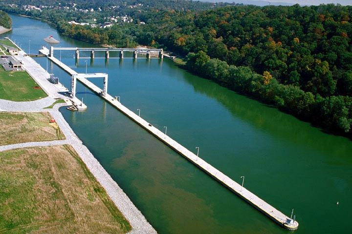
Point Marion Lock and Dam, previously known as Lock and Dam Number 8, is one of nine navigational structures on the Monongahela River between Pittsburgh, Pennsylvania and Fairmont, West Virginia. Maintained and built by the U.S. Army Corps of Engineers, the gated dam forms an upstream pool that is 11.2 miles (18.0 km) long, stretching to the base of the Morgantown Lock and Dam. It is located at river mile 90.5 (river kilometer 145.6).
Contents
There is one lock chamber on the left descending bank of the river at the dam, 84 feet (26 m) wide and 720 feet (220 m) long. The reservoir formed by the dam is also a municipal and industrial water supply.
Fishing trip to point marion lock and dam
References
Point Marion Lock and Dam Wikipedia(Text) CC BY-SA