
Country New Zealand Territorial authority | Region Manawatu-Wanganui Mayor Andy Watson | |
 | ||
Pohonui-Porewa is a meshblock located in the central part of Rangitikei District of the Manawatu-Wanganui region of New Zealand's North Island. According to the 2013 census, it had a population of 2,031 inhabitants.
Contents
Geography
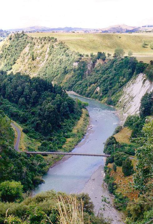
Several rivers run through the meshblock, including the Rangitikei River, Moawhango River, the Mangawharariki River and the Kawhatau River.
The geographic area of this meshblock encompasses a mostly rural area sparsed with a few small townships; these are: Mangamahu, Ohingaiti, Papanui Junction, Utiku and Taoroa Junction. Pohonui-Porewa envelops Hunterville and Taihape.
Pohonui-Porewa has the following boundaries: Moawhango to the north, Whanawhana (Hastings, Hawke's Bay) to the northeast, Tikokino (Central Hawke's Bay) to the east, Pohangina (Manawatu) to the southeast, Kiwitea (Manawatu) to the south, Tokorangi-Hiwinui (Manawatu) and Lake Alice to the southwest and Fordell-Kakatahi (Whanganui) to the west.
Local politics
As part of the Rangitikei District, the current Mayor of Rangitikei since 2013 is Andy Watson.
Pohonui-Porewa forms part of the Hunterville and Taihape wards of the Rangitikei District Council, which elect one and three, respectively, of the eleven district councillors. The one representative of the Hunterville ward is Dean McManaway. The three councillors of the Taihape ward are Richard Aslett, Angus Gordon and Ruth Rainey. The mayor and councillors are all due for re-election in October 2016.
National government
Pohonui-Porewa, like the rest of the Rangitikei District, is located in the general electorate of Rangitīkei and in the Māori electorate of Te Tai Hauāuru. Rangitīkei is a safe National Party seat since the 1938 election with the exception of 1978–1984 when it was held by Bruce Beetham of the Social Credit Party. Since 2011 it is held by Ian McKelvie.
Te Tai Hauāuru is a more unstable seat, having been held by three different parties since 1996, i.e. New Zealand First, the Māori Party and the Labour Party. Since 2014 it is held by Adrian Rurawhe of the Labour Party.
Education
Due to its sparse population, the meshblock itself does not have any schools. However, as Hunterville and Taihape are enclaves of Pohonui-Porewa children attend school mostly in those two locations. These include a number of primary schools and one secondary school, Taihape Area School.
Demographics
Pohonui-Porewa had a population of 2,031 according to the 2013 census. This is a decrease of 48, or 2.3 percent, since the 2006 census. There were 810 occupied dwellings, 153 unoccupied dwellings, and 3 dwellings under construction.
Of the residential population, 1,059 (52.1%) were male compared to 48.7% nationally, and 972 (47.9%) were female, compared to 51.3% nationally. The district had a median age of 41.1 years, 3.1 years above the national median age of 38.0 years. People aged 65 and over made up 12.6% of the population, compared to 14.3% nationally, and people under 15 years made up 21.7%, compared to 20.4% nationally.
The meshblock's ethnicity is made up of (national figures in brackets): 89.3% European (74.0%), 15.6% Māori (14.9%), 0.9% Asian (11.8%), 0.9% Pacific Islanders (7.4%), 0.0% Middle Eastern, Latin American or African (1.2%), and 2.9% Other (1.7%).
Pohonui-Porewa had an unemployment rate of 2.9% of people 15 years and over, compared to 7.4% nationally. The median annual income of all people 15 years and over was $30,800, compared to $28,500 nationally. Of those, 34.7% earned under $20,000, compared to 38.2% nationally, while 24.7% earned over $50,000, compared to 26.7% nationally.
Roads
State Highway 1 goes through the central and eastern parts of the meshblock, beginning just before Taihape in central northern Pohonui-Porewa and continuing down through Mangaweka and Hunterville as it leaves the area on towards Lake Alice. The North Island portion of this national state highway begins at Cape Reinga and ends at Wellington International Airport.
Public transport
InterCity runs several daily and non-daily services throughout the area. These routes include: Auckland–Wellington, Wellington–Auckland, Tauranga–Wellington and Wellington–Tauranga.
The area used to be serviced by the North Island Main Trunk (or Overlander), a railway line connecting Auckland and Wellington. However, in 2012 the Overlander was replaced by the Northern Explorer, which has fewer stops and does not stop in Pohonui-Porewa.
The nearest airports to the town are Whanganui Airport, located 62 km west of Hunterville, and Palmerston North Airport, located 64 km south from Hunterville. Both airports are domestic only.