
District Český Krumlov Postal code 382 83 Population 2 (2014) | Elevation 910 m (2,990 ft) Area 26.38 km² | |
 | ||
Poho na umav
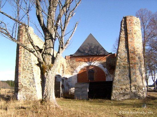
Pohoří na Šumavě (German: Buchers, Bucherwald, Buchers bei Kaplitz, Buchers im Böhmerwald, Czech: Puchéř, Buchoř (1869–1910) or Půchoří) is a former village and municipality (obec) in Český Krumlov District in the South Bohemian Region of the Czech Republic. The settlement has been abandoned since the 1970s but now is being restored step by step. The village was named Pohoří na Šumavě in 1923 and nowadays is part of the municipality of Pohorská Ves.
Contents
- Poho na umav
- Map of PohoC599C3AD na C5A0umavC49B 382 83 PohorskC3A1 Ves Czechia
- Xtz 750 poho na umav
- Nature protection
- References
Map of Poho%C5%99%C3%AD na %C5%A0umav%C4%9B, 382 83 Pohorsk%C3%A1 Ves, Czechia
Pohoří na Šumavě lies approximately 35 kilometres (22 mi) south-east of Český Krumlov, 43 km (27 mi) south of České Budějovice, and 165 km (103 mi) south of Prague.
Xtz 750 poho na umav
Nature protection
There are some small protected natural areas in the cadastre of Pohoří na Šumavě:
References
Pohoří na Šumavě Wikipedia(Text) CC BY-SA