Established 1921 Area code 380-44 Area 34.04 km² | City Kiev Time zone EET (UTC+2) Website www.podilr.gov.ua | |
 | ||
The Podilskyi District (Ukrainian: Подільський район) is an urban district of Kiev, the capital of Ukraine. Its population was 177,563 at the 2001 census. The district takes its name from the historic Podil neighborhood which it includes within its boundaries.
Contents
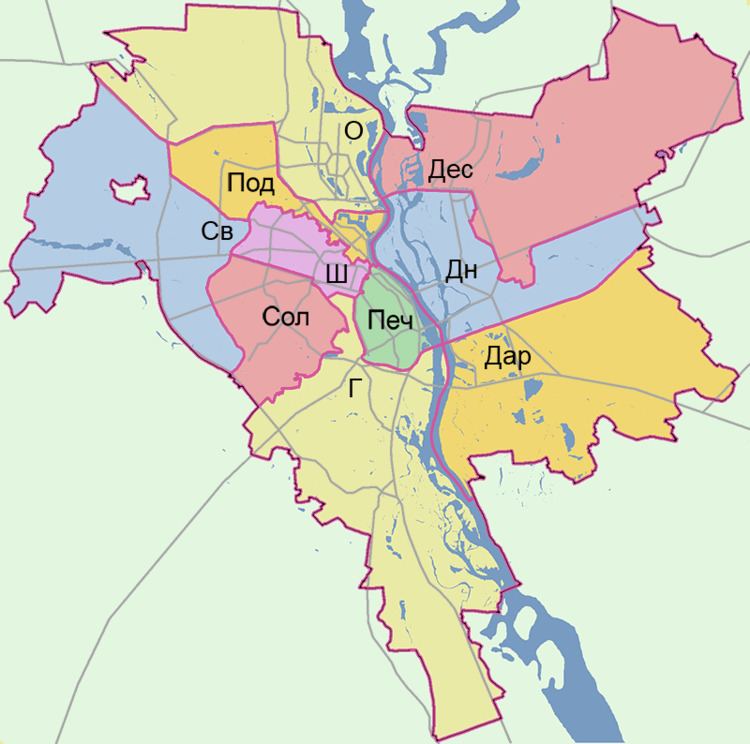
Map of Podil's'kyi district, Kiev, Ukraine
The Podilskyi District as an administrative entity was formed in 1921 on one of the largest historical neighborhoods in Kiev. In May 2001 the Podilskyi District celebrated its 80th anniversary of its foundation. The district remains as one of the main business, transport and industrial areas of Kiev.
There are currently 50 large industrial organizations based here. Although most of the industrial sites are phased out of the region, they dominate the adjacent neighborhoods to the north, named today "Podilsko-Kurenivskiy promraion".
Neighborhoods
The Podilskyi District includes the following historical neighborhoods of Kiev within its boundaries:
Transport
The Podilskyi District is connected to the city's metro system by three stations on the Kurenivsko-Chervonoarmiyska Line: Tarasa Shevchenka, Kontraktova Ploshcha (named after the Kontraktova Square), and Poshtova Ploshcha (named after the Poshtova Square).
