
1504–1793 → Established 1504 Area 21,800 km² | Capital Polatsk Political subdivisions none | |
 | ||
Po ock voivodeship
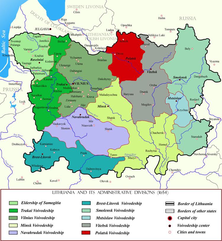
Połock Voivodeship (Polish: Województwo połockie) was a unit of administrative division and local government in the Polish-Lithuanian Commonwealth (Grand Duchy of Lithuania) (now it is the territory of Belarus) since the 15th century until the partitions of Poland in 1793.
Contents
The voivodeship history can be traced to the Principality of Polotsk, conquered by the Grand Duchy of Lithuania around late 14th / early 15th centuries. From 1504 the former Principality was recognized as a voivodeship.
Zygmunt Gloger in his monumental book Historical Geography of the Lands of Old Poland provides this description of the Połock Voivodeship:
“Połock, in Latin Polocia, Polocium, lies on the right bank of the Dvina, and is regarded as one of the oldest gords of Rus’. In the 13th century, the Principality of Polotsk was ruled by Kievan princes, but in app. 1225 it was seized by the Lithuanians under Duke Mindaugas (...) Duke Vytautas named the first starosta of Połock, and in app. 1500, the starosta was renamed into the Voivode of Połock, while the Duchy was turned into a voivodeship, divided into two equal halves by the Dvina (...)
The voivodeship had two senators, who were the Voivode and the Castellan of Połock (...) Since it was not too large and its population was not numerous, furthermore, its capital was located in the middle, the voivodeship was not divided into counties. Its courts were located in Połock, where the sejmiks also took place. Połock Voivodeship had two envoys in the Sejm, and two deputies to the Lithuanian Tribunal”.
Name
Population
Administration
Voivodeship Governor (Wojewoda) seat:
Administrative division:
Number of Senators:
Number of envoys in the Sejm: