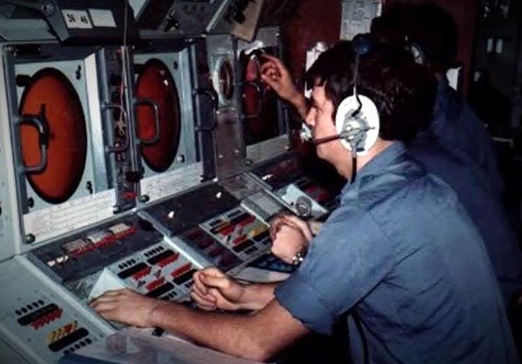
In naval terminology a Plot is a graphic display that shows all collated data from a ship's on-board sensors i.e. radar, sonar and EW systems. They also displayed information from external sources i.e. other vessel or aircraft reports. There are four different types of plot, each with varying capabilities i.e. range, depending on their role;
Air Plot: Used for tracking air contacts i.e. planes and EW informationSurface Plot: Used for tracking contacts on the surface of the water i.e. other ships. It can also perform a variety of roles such as;Providing a trace of a ship's own course and speed over timePlotting the position of a man overboardCan be used in naval gunfire support missions to plot unidentified contacts and keep track of friendly forcesIt also plays an important part in anti-submarine warfare operations and using TorpedoesSub-Surface Plot: Used for tracking contacts below the surface of the water i.e. submarinesGeneral Operations Plot: Used for tracking shipping on a large scale chart. Was also used to display exercise boundaries, airlanes and other significant features of maritime interest. In the Royal Australian Navy, the scale used was generally 5 or 10 miles (8.0 or 16.1 km) per 1 inch (25 mm).