
Elevation 2,985 m (9,793 ft) State Graubünden | ||
 | ||
Mountains Weissfluhjoch, Parpaner Rothorn, Aroser Rothorn, Aroser Weisshorn, Weissfluh Similar Albula Alps, Oberhalbstein Alps, Livigno Alps, Aroser Rothorn, Weissfluh | ||
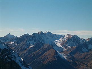
The Plessur Alps are a mountain range in the Alps of eastern Switzerland. They are considered to be part of the Western Rhaetian Alps. They are named after the river Plessur, which originates from the center of the ranges. The Plessur Alps are separated from the Glarus Alps in the west by the Rhine valley; from the Rätikon range in the north by the Landquart river valley (Prättigau); from the Albula Alps in the south-east by the Landwasser river valley; from the Oberhalbstein Alps in the south by the Albula river valley.
The Plessur Alps are drained by the rivers Rhine, Plessur, Landwasser and Landquart. The ski resort Arosa lies in the middle of the range.
Peaks of the Plessur Alps are the Aroser Rothorn (highest, 2,985 m (9,793 ft)) and Stätzer Horn (2,576 m (8,451 ft)).
A mountain pass in the Plessur Alps is the Strela Pass, from Davos to Langwies, elevation 2,377 m (7,799 ft).