
- summer (DST) CEST (UTC+2) Area 57.13 km² | Elevation 350 m Local time Tuesday 1:53 PM | |
 | ||
Weather 13°C, Wind SW at 19 km/h, 58% Humidity Points of interest Abbaye de Plasy, Fantasy Golf, Centrum stavitelského dědictví P, Barokní sýpka, Žebnický vodopád | ||
Plasy ( [ˈplasɪ]; German: Plass) is a small town in the Plzeň Region of the Czech Republic. It lies on the Střela River, some 20 km (12 mi) to the north of Plzeň, the regional capital.
Contents
Map of 331 01 Plasy, Czechia
Plasy is also a Municipality with Commissioned Local Authority within the Kralovice Municipality with Extended Competence.
With its scenic surroundings, the town is an important tourist center, but has no significant industry.
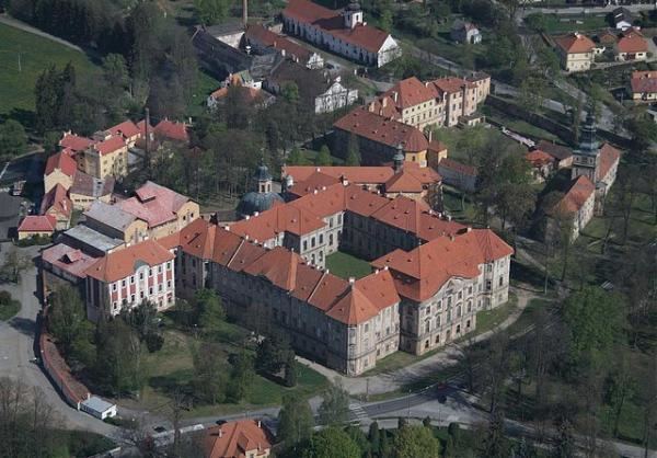
Cistercian monastery
Plasy was home to a Cistercian monastery during the Middle Ages. The geographer, historian, cartographer, and musician Mauritius Vogt (1669 - 1730) was educated there and later joined the order. The monastery at Plasy provided a base for Vogt's travels while he wrote Das jetzlebende Königreich Böhmen... (Illustrated Geography and History of Bohemia) which was published in 1712 to great acclaim for its excellent illustrations and maps. A surviving copy of the book is on display at the Lobkowicz Palace in Prague.