
Country Thailand Time zone THA (UTC+7) Geocode 4802 Province Nakhon Phanom Province | Seat Pla Pak Postal code 48160 Area 547.1 km² | |
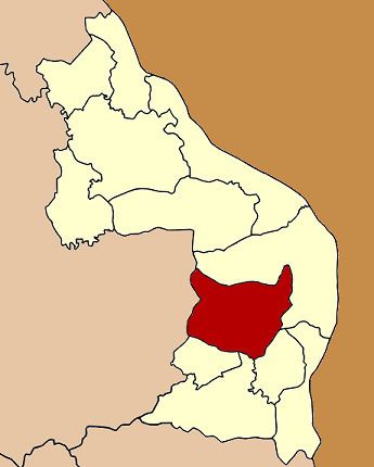 | ||
Pla Pak (Thai: ปลาปาก) is a district (Amphoe) in the province Nakhon Phanom in the northeast of Thailand.
Contents
Map of Pla Pak District, Nakhon Phanom, Thailand
Geography
Neighboring districts are (from the north clockwise) Mueang Nakhon Phanom, Renu Nakhon, Na Kae and Wang Yang of Nakhon Phanom Province, and Phon Na Kaeo and Kusuman of Sakon Nakhon Province.
History
The area of the district was at first a tambon of Mueang Nakhon Phanom district. On June 16, 1965 it became a minor district (King Amphoe) consisting of the three tambon Pla Pak, Nong Hi and Ku Ta Kai. The first district officer was Winai Bunratnaplin. On November 17, 1971 it was upgraded to a full district.
Administration
The district is subdivided into 8 subdistricts (tambon), which are further subdivided into 85 villages (muban). Pla Pak itself has township (thesaban tambon) status and covers part of the tambon Pla Pak. There are further 8 tambon Tambon administrative organization (TAO).