
Elevation 2,844 m Prominence 457 m | First ascent 1864 Mountain range Alps, Glarus Alps | |
 | ||
Similar Säntis, Ebenalp, Chäserrugg, Tödi, Gonzen | ||
Skigebiet pizol im heidiland
The Pizol is a mountain in the Glarus Alps of northeastern Switzerland, overlooking Wangs in the canton of St. Gallen. At 2,844 metres above sea level, it is the highest summit of the chain separating the valleys of the Seez and the Tamina rivers, and the highest mountain lying entirely within the canton of St. Gallen.
Contents
Map of Pizol, 7326 Mels, Switzerland
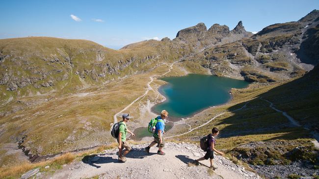
There are five mountain lakes (Pizolseen) on Pizol: Wangsersee at Pizolhütte, Wildsee, Schottensee, Schwarzsee (2368 m) and Baschalvasee (2174 m). A small cirque glacier, the Pizolgletscher, lies above 2,600 metres on the northern side of the mountain.
Pizol Hut lies at 2,227 metres (7,306 ft).
References
Pizol Wikipedia(Text) CC BY-SA