
Area 375 acres (1.52 km) | Created 1924 (1924) | |
 | ||
Location 11430 State Route 46Boonville, New York Similar Delta Lake State Park, Whetstone Gulf State Park, Steuben Memorial State Hist, Betty and Wilbur Davis Sta, Hunts Pond State Park | ||
Pixley falls state park
Pixley Falls State Park is a 375-acre (1.52 km2) New York state park located in the town of Boonville in Oneida County, New York, United States. The park is located on New York State Route 46 and is 18 miles (29 km) north of Rome and six miles (9.7 km) miles southwest of Boonville, near the community of Hurlbutville.
Contents
FacilitiesEdit
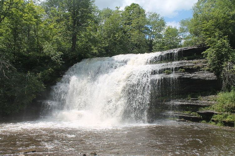
Open all year, the park gets its name from a 50-foot (15 m) waterfall, accessible via a short hiking trail. The park offers picnicking, a nature trail, hiking, fishing, seasonal hunting, and cross country skiing. The park has steep wooded hills, a mountain trout stream, and a trail that runs along the ruins of the 19th-century Black River Canal.
Camping, once permitted at the park, has not been allowed since the park became day-use only in 2010.