
- right Tinkers Creek | - elevation 226 ft (69 m) - elevation 0 ft (0 m) | |
 | ||
- location Joint Base Andrews Naval Air Facility | ||
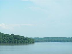
Piscataway Creek is an 18.6-mile-long (29.9 km) tributary of the Potomac River in Prince George's County, Maryland. The creek is a tidal arm of the Potomac for its final 2.5 miles (4.0 km), entering the Potomac at Fort Washington Park. Tinkers Creek is a tributary to Piscataway Creek, converging from the north 4.5 miles (7.2 km) upstream of the mouth of the Piscataway. The United States Geological Survey records two variant names for Piscataway Creek: Pascattawaye Creek and Puscattuway Creeke.
Map of Piscataway Creek, Maryland, USA
The Fort Washington Light was built to provide guidance for mariners entering Piscataway Creek from the Potomac River.
References
Piscataway Creek Wikipedia(Text) CC BY-SA