
Country State | Language spoken Hindi District | |
 | ||
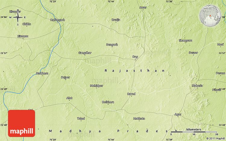
Map of Piploda
Piploda is a town and a nagar panchayat in Ratlam district in the Indian state of Madhya Pradesh.
Contents
- Map of Piploda
- Piploda song song by vishwas and manglesh derashree piploda
- History
- Geography
- Demographics
- References
Piploda song song by vishwas and manglesh derashree piploda
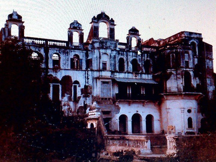
History
Before Indian independence, Piploda was the capital of the princely state of the same name. It was ruled by Rajputs of the Dodiya clan. The state had an area of 91 km². Piploda was a dependency of Jaora state until 1924, when it became a separate state. The rulers acceded to the Government of India on June 15, 1948, and Piploda became part of Ratlam District of Madhya Bharat state. Madhya Bharat was merged into Madhya Pradesh on November 1, 1956.
Geography
Piploda is located at 23.35°N 75.43°E / 23.35; 75.43. It has an average elevation of 470 metres (1541 feet).
Demographics
As of 2001 India census, Piploda had a population of 7302. Males constitute 51% of the population and females 49%. Piploda has an average literacy rate of 60%, higher than the national average of 59.5%: male literacy is 71%, and female literacy is 49%. In Piploda, 15% of the population is under 6 years of age.